


Meteorologist Myles Henderson’s First Warning Forecast
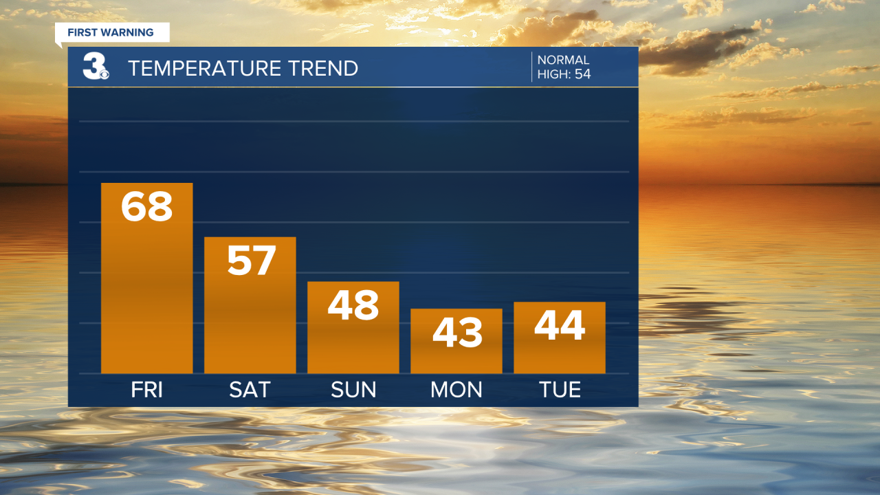
Warm again today, getting cooler this weekend. Tracking a soggy end to the weekend.
Another gloomy and foggy morning. We will see mostly cloudy skies with scattered showers this morning to midday. Clouds will start to clear out this afternoon with temperatures warming to the upper 60s.

Expect partly to mostly cloudy skies on Saturday with a few showers possible (mostly in NC). Highs will drop to the mid and upper 50s tomorrow.
Rain will become more widespread on Sunday as an area of low pressure develops off the Carolina coast. Highs will only reach the upper 40s on Sunday.
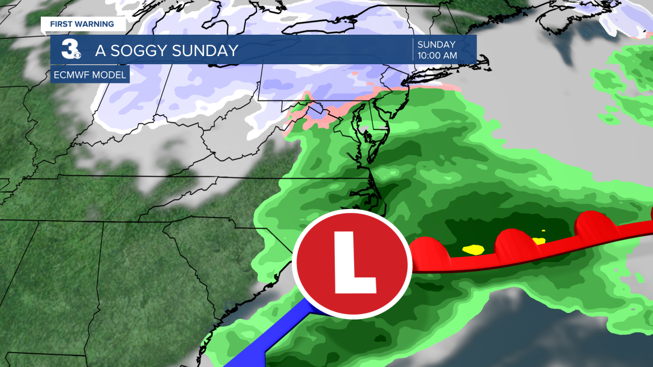
With temperatures in the low to mid 30s Sunday night to Monday morning, we could see a wintry mix before the moisture exits.
We are headed back to a chilly stretch with highs in the mid 40s to start next week. We will climb to the 50s by midweek.
Today: Scattered Showers. Highs in the upper 60s. Winds: SW 5-15
Tonight: Partly Cloudy. Lows in the mid 40s. Winds: W 5-15
Tomorrow: Mix of Clouds. Highs in the upper 50s. Winds: W/N/E 5-10
Weather updates on social media:
Facebook: MylesHendersonWTKR
Instagram: @MylesHendersonWTKR
