Meteorologist Maddie Kirker's First Warning Forecast:
Tired of the winter temps? Never fear! A warm front is near! Speaking of, clouds will be on the increase ahead of it's arrival. As winds back in from the south, temperatures will only fall to the upper 30s before warming to the low 40s by sunrise on Wednesday. So already, tomorrow morning looking not as cold.
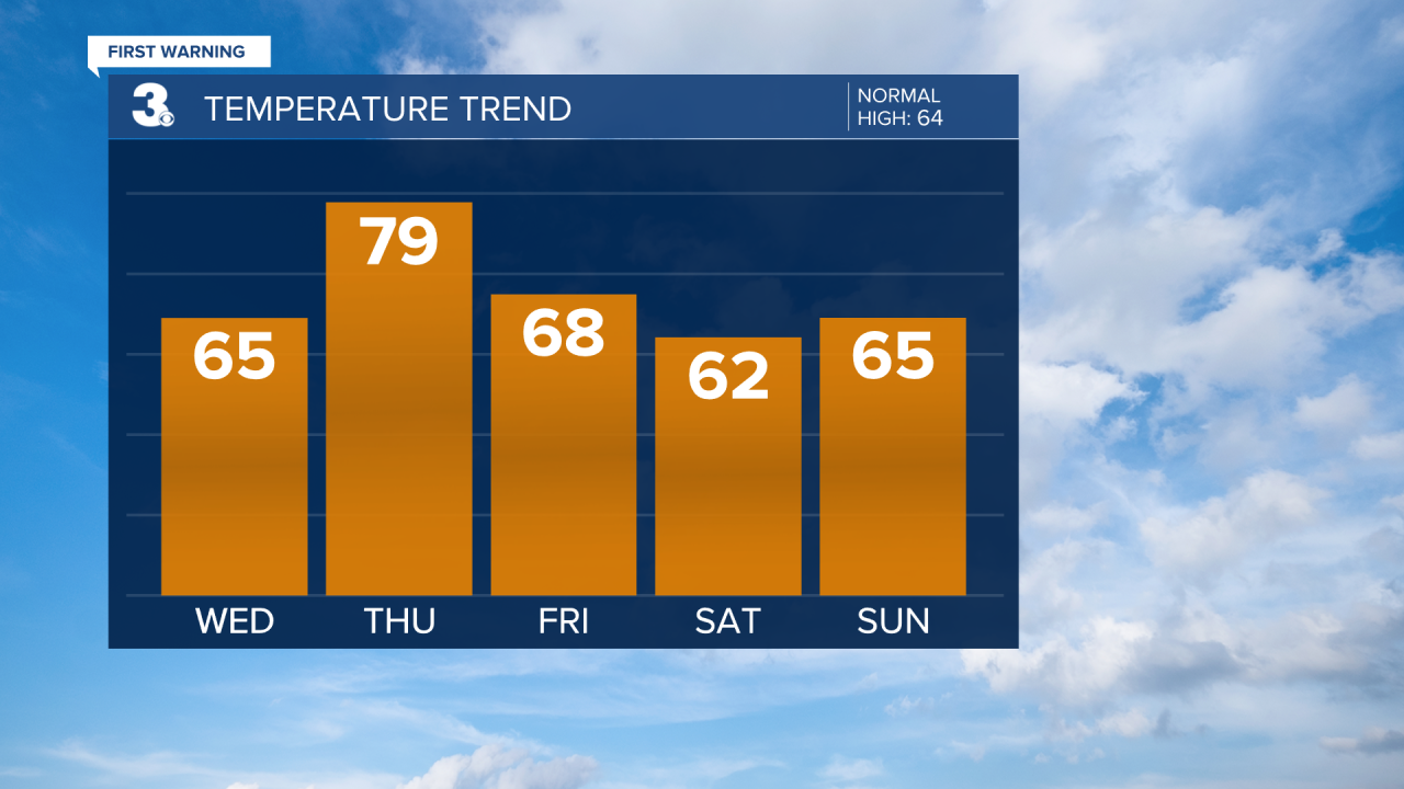
Temperatures will rebound nicely by Wednesday and only trend warmer as we head into Thursday. Thursday will be the warmest day of the week and temperatures could touch the 80 degree mark before it's all said and done. It'd be nice if we were 80 and dry... but it isn't looking that way.
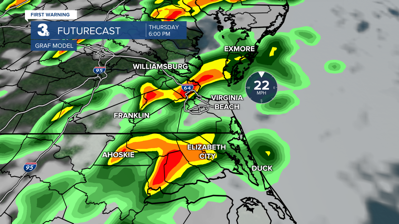
A rather strong cold front (similar to last weeks) is set to make it's way across the country over the next few days. Impacting locations such as Texas, Mississippi and then us. Here's a look at where the storms could be by Thursday evening.
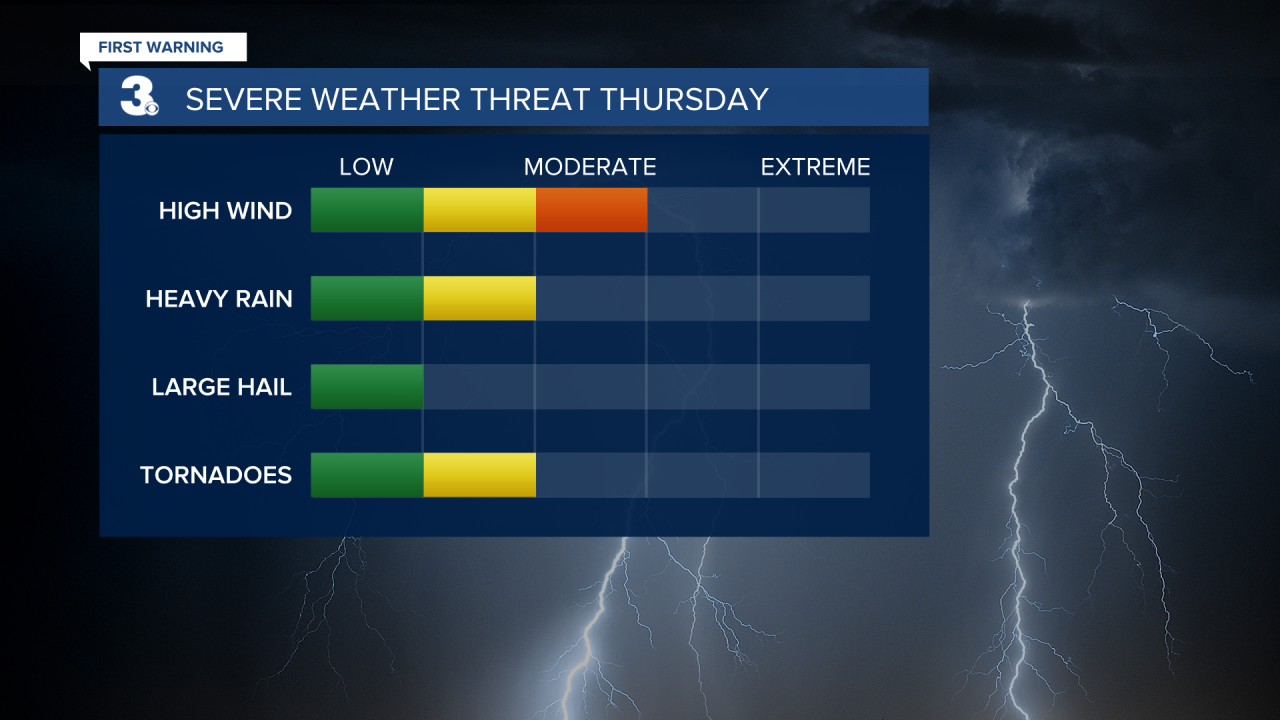
Our area is already under a close eye for the threat of strong to severe storms Thursday afternoon through early Friday morning. Below is the 3 day severe weather outlook put out from the Storm Prediction Center. This is where we've already got a level 2 chance of Severe Weather for the western half of our area between 8 am Thursday and 8 am Friday.

If we were to pinpoint the highest severe threats, damaging winds would be top of the list. Followed by heavy downpours and even tornadoes. As we track this threat of severe weather, make sure you check back with us right here for the latest updates.