


Meteorologist Myles Henderson’s First Warning Forecast
From freezing to the 70s this week. Tracking a chance for rain and a severe storm threat on Thursday.
We will see sunshine today with a few clouds mixing in. Highs will struggle to reach 50 this afternoon, about 15 degrees below normal for this time of year. More clouds will build in tonight with lows in the upper 30s and low 40s.

More spring-like temperatures return tomorrow. We will jump to the mid and upper 60s on Wednesday. Expect a mix of partly to mostly cloudy skies with a stray shower possible.

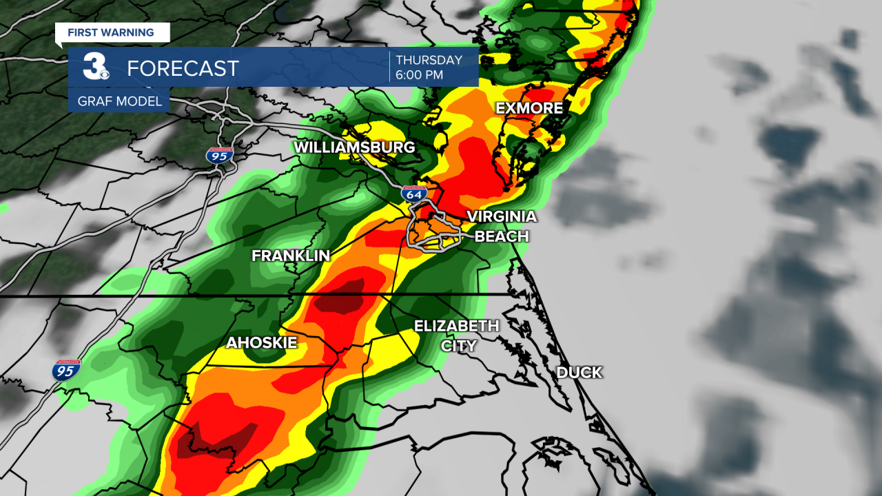
We will warm to the upper 70s on Thursday, the warmest day of the week. A cold front is set to move in later Thursday, bringing us a chance for showers and storms. As of now, the highest rain chances will be Thursday afternoon to evening. Strong to severe thunderstorms are possible. It will be windy again with SW winds at 15 to 25 and gusts to 35 mph.
Skies will clear out on Friday with highs in the upper 60s. It will still be windy with a west wind at 10 to 20 and gusts to near 30 mph. Highs will linger in the low to mid 60s this weekend.
Today: A Few Clouds, Breezy. Highs near 50. Winds: NW 5-15
Tonight: Partly Cloudy. Lows in the upper 30s. Winds: SW 5-10
Tomorrow: Mix of Clouds, Warmer. Highs in the upper 60s. Winds: S 5-15
Weather & Health
Pollen: Medium-High (Juniper, Elm, Poplar)
UV Index: 5 (Moderate)
Air Quality: Good (Code Green)
Mosquitoes: Low
Weather updates on social media:
Facebook: MylesHendersonWTKR
Twitter: @MHendersonWTKR
Instagram: @MylesHendersonWTKR
