


Meteorologist Myles Henderson’s First Warning Forecast
Warming back to the 80s to end to the week. Tracking a threat for severe storms on Friday. More sunshine and several days in the 80s for Memorial Day weekend.
Clouds will start to break up this afternoon and some sunshine will mix in. Temperatures will climb to 80 degrees, near normal for this time of year.
Showers and storms will return for Friday as a cold front moves in. The biggest rain chances will be Friday afternoon to evening. Strong to severe storms are expected with damaging wind gusts, localized flooding, pockets of hail, and isolate tornadoes possible. Highs will warm to the mid 80s on Friday and winds will kick up.

The warmer temperatures will stick around for Memorial Day weekend with highs in the low to mid 80s. Expect partly cloudy skies Saturday with leftover scattered showers/storms. More sunshine will mix in for Sunday and Monday with a lower rain chance.

Today: Mostly to Partly Cloudy. Highs near 80. Winds: E 5-10
Tonight: Cloudy, Showers. Lows in the upper 60s. Winds: SE 5-10
Tomorrow: PM Storms, Severe Threat, Windy. Highs in the mid 80s. Winds: S 10-20G30
Weather & Health
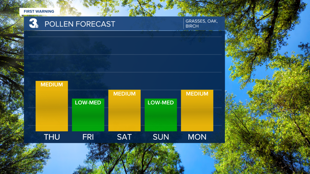
Pollen: Medium (Grasses, Oak, Birch)
UV Index: 7 (High)
Air Quality: Good (Code Green)
Mosquitoes: High
Today in Weather History (NWS Wakefield)
May 26th
1994 F1 Tornado: Southampton Co, F0 Tornado Suffolk
2003 Flash Flooding: Central Virginia
Weather updates on social media:
Facebook: MylesHendersonWTKR
Twitter: @MHendersonWTKR
Instagram: @MylesHendersonWTKR
