


Derrah Getter's First Warning Forecast
Temperatures climb midweek; snow moves in late week.
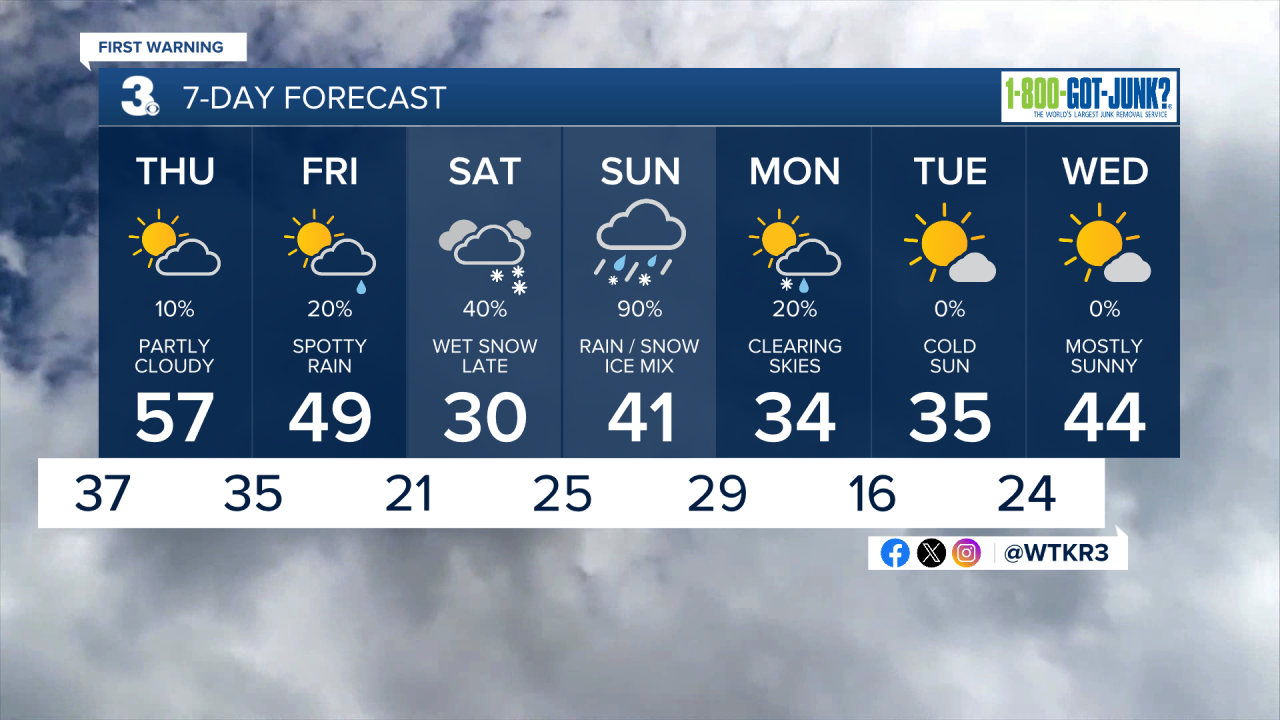
Wednesday temperatures make a run for 50. We’ll see mostly sunshine throughout the afternoon. More clouds build in this evening ahead of an approaching cold front. A spot shower or two will be possible, but conditions will remain mostly dry.
Temperatures approach 60 degrees on Thursday. Skies will start out cloudy but gradually clear throughout the afternoon and evening.
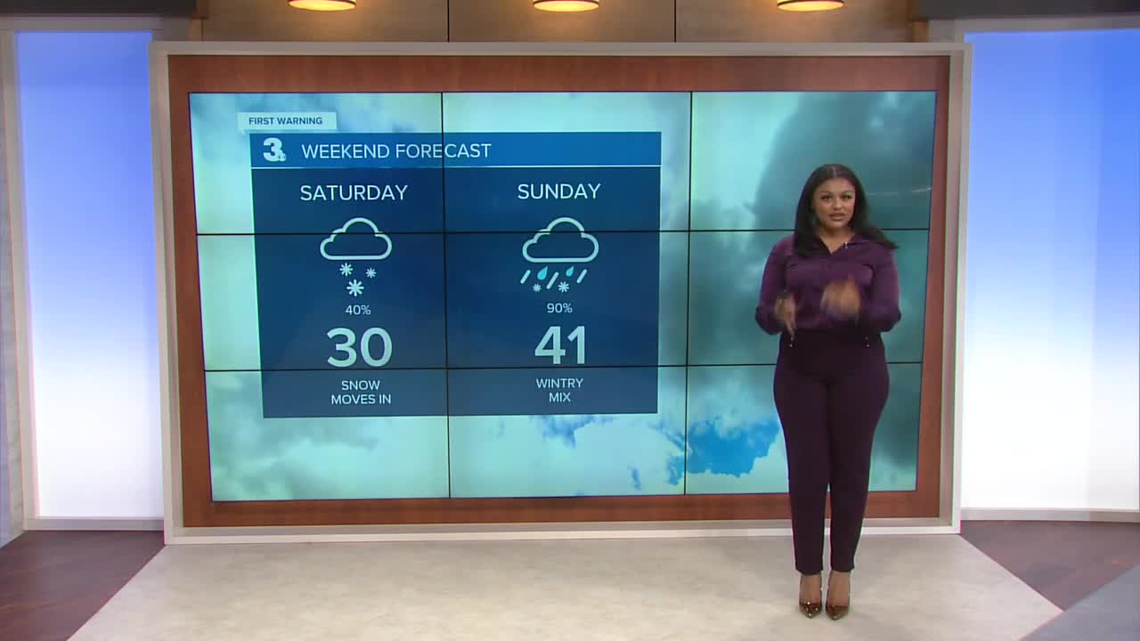
More moisture returns to the area late week. Scattered showers will be possible on Friday. The rain turns into snow on Saturday when temperatures aren’t forecast to reach above freezing. On Sunday, this will turn into a mix as temperatures hover around or above freezing. Some lingering snow showers will be possible Monday morning.
Much cooler and brighter conditions return next week with highs only in the low to mid 30s.
Let's connect on social media!
Forecaster Derrah Getter:
For weather updates on Facebook: HERE
For weather updates on X: HERE
Follow me on Instagram: HERE
Check out the Interactive Radar on WTKR.com: Interactive Radar
