


Meteorologist Myles Henderson’s First Warning Forecast
Cool again today but not as windy. Warming to the 70s this weekend and 80s next week. Tracking several rain chances next week.
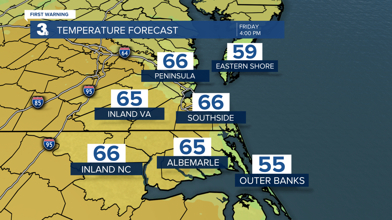
Another nice but cool day today. Highs will reach the mid 60s this afternoon, a few degrees warmer than yesterday. Most of the area will see sunshine today but a few extra clouds will brush by for parts of inland NE NC and inland Southside. Rain chances remain low.
We will see a mix of sun and clouds on Saturday with more sun to the north and more clouds to the south. A stray shower is possible, but most areas will stay dry. Highs will return to the mid (maybe upper) 60s.
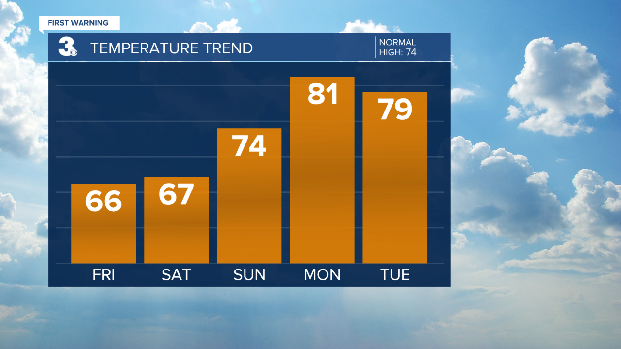
Look for a mix of partly to mostly cloudy skies on Sunday. A few showers are possible during the day with a bigger rain chance Sunday night. Highs will warm to the mid 70s on Sunday, near normal for this time of year.
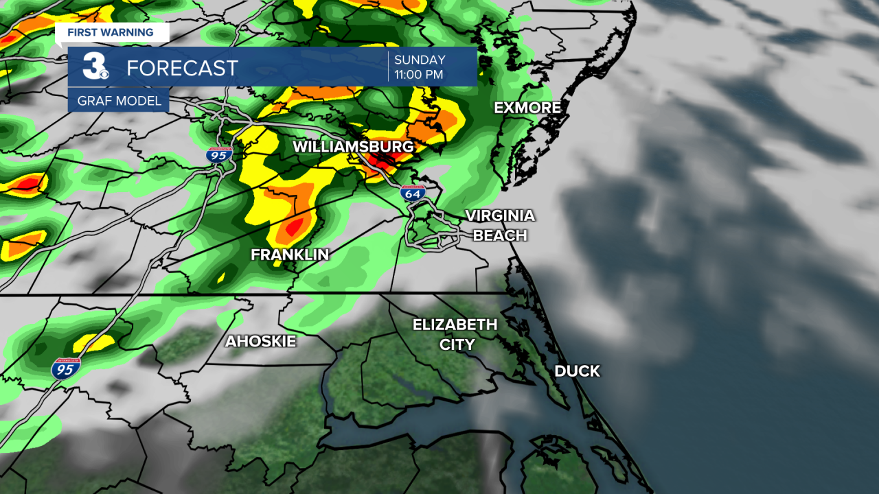
We will warm to the upper 70s and low 80s early next week but get your umbrella ready. We are tracking several back-to-back chances for showers through next week. The first round will be Sunday night to Monday morning. Round two on Wednesday and tracking another for Friday.
Today: A Few Clouds. Highs in the mid 60s. Winds: N 5-10
Tonight: A Few Clouds. Lows in the upper 40s. Winds: S 5-10
Tomorrow: Partly Cloudy. Highs in the mid 60s. Winds: NE/E 5-10
Weather & Health
Pollen: Medium-High (Oak, Birch, Sweetgum)
UV Index: 8 (Very High)
Air Quality: Good (Code Green)
Mosquitoes: Moderate

Weather updates on social media:
Facebook: MylesHendersonWTKR
Twitter: @MHendersonWTKR
Instagram: @MylesHendersonWTKR
