


Meteorologist Myles Henderson’s First Warning Forecast
Building heat and humidity. Tracking showers and storms Monday to Tuesday. A cooler midweek, then warming up again.
Another nice day but taking a step warmer. Highs will reach the upper 80s today, about 5 degrees warmer than yesterday. We will see mostly sunny skies with a few clouds mixing in from time to time.

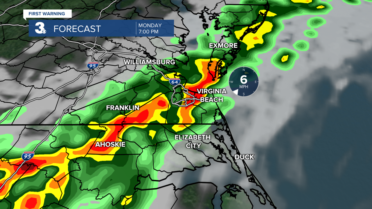
We will start Monday with some sunshine, but clouds will build in through the day as a cold front approaches. Expect showers and storms in the afternoon to evening, with the biggest chance after 5 PM. Highs will reach the mid to upper 80s and it will be humid.
Showers will move out early Tuesday and sunshine will return by the afternoon. Behind the cold front, expect some cooler and less humid air. Highs will only reach the upper 70s Tuesday.

Heat and humidity will build for the end of the week. Highs will climb through the 80s Wednesday and Thursday to the 90s by Friday. Expect mostly sunny to partly cloudy skies with low rain chances for the second half of the week.
Today: Mostly Sunny. Highs in the upper 80s. Winds: S 5-10
Tonight: Mainly Clear. Lows near 70. Winds: S 5-10
Tomorrow: Late-Day Storms. Highs in the upper 80s. Winds: SW 5-10
Weather & Health
Pollen: Low-Medium (Grasses)
UV Index: 10 (Very High)
Air Quality: Good (Code Green)
Mosquitoes: Extreme
Tropical Update
Shower and thunderstorm activity has increased in association with a tropical wave over the central tropical Atlantic. Environmental conditions appear conducive for further development, and a tropical depression is likely to form during the early to middle part of this week. This system is forecast to move west at 15 to 20 mph over the tropical Atlantic, approach the Windward Islands on Tuesday, and move across the southeastern Caribbean Sea on Wednesday and Thursday.
* Formation chance through 48 hours: Medium (40%)
* Formation chance through 5 days: High (70%)

An area of cloudiness and thunderstorms extending from southeastern Louisiana across the northeastern Gulf of Mexico and the Florida peninsula is associated with a trough of low pressure. Slow development of this system could occur as it drifts west across the northern Gulf of Mexico over the next few days.
* Formation chance through 48 hours: Low (0%)
* Formation chance through 5 days: Low (20%)
Weather updates on social media:
Facebook: MylesHendersonWTKR
Twitter: @MHendersonWTKR
Instagram: @MylesHendersonWTKR
