


First Warning Forecast:
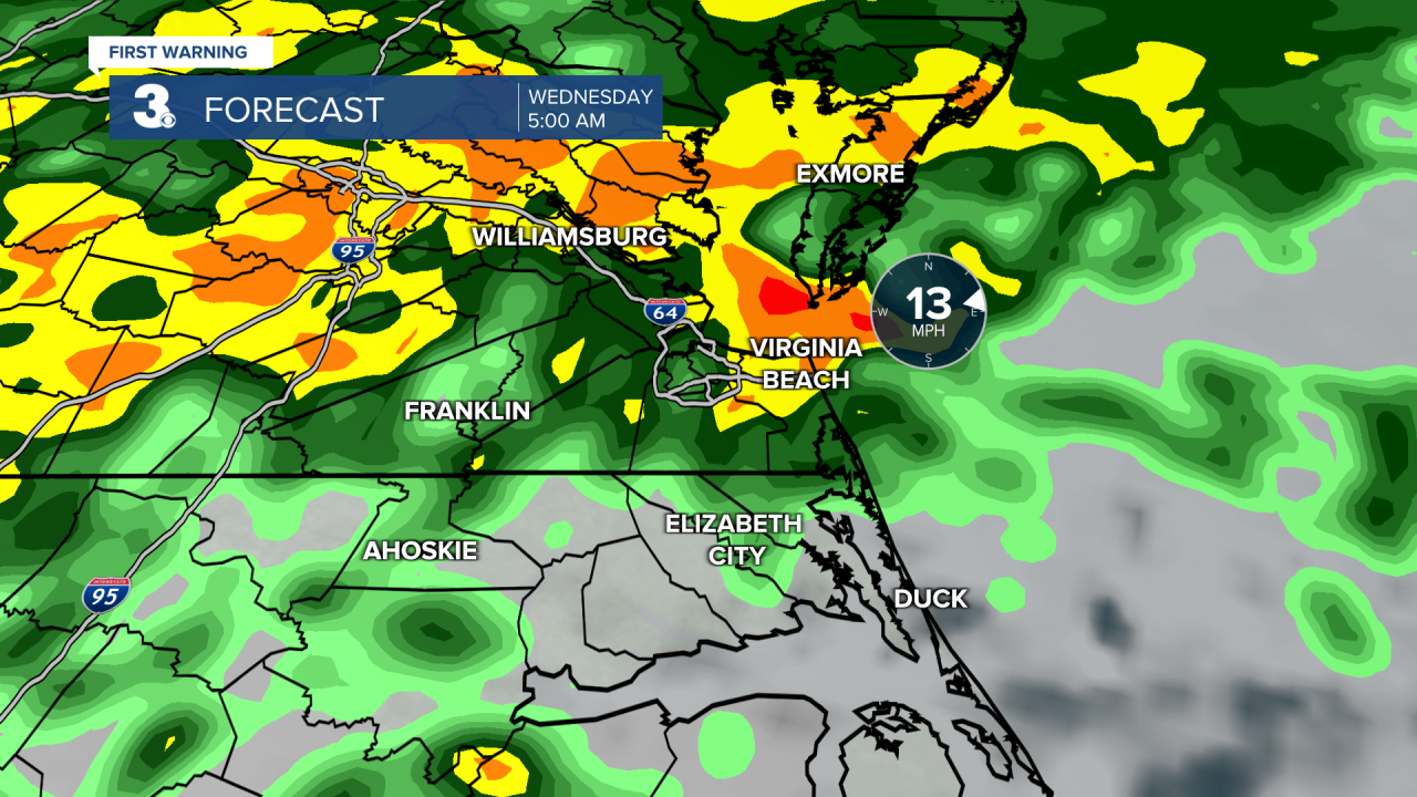
Widespread rain will spread across the region as a stationary boundary and area of low pressure ride up the Carolina coast. Rain will be heavy at times, especially Wednesday morning. We could even hear a few rumbles of thunder. Take a look below for an hour-by-hour radar look of what to expect. Lows will be in the low 40s.
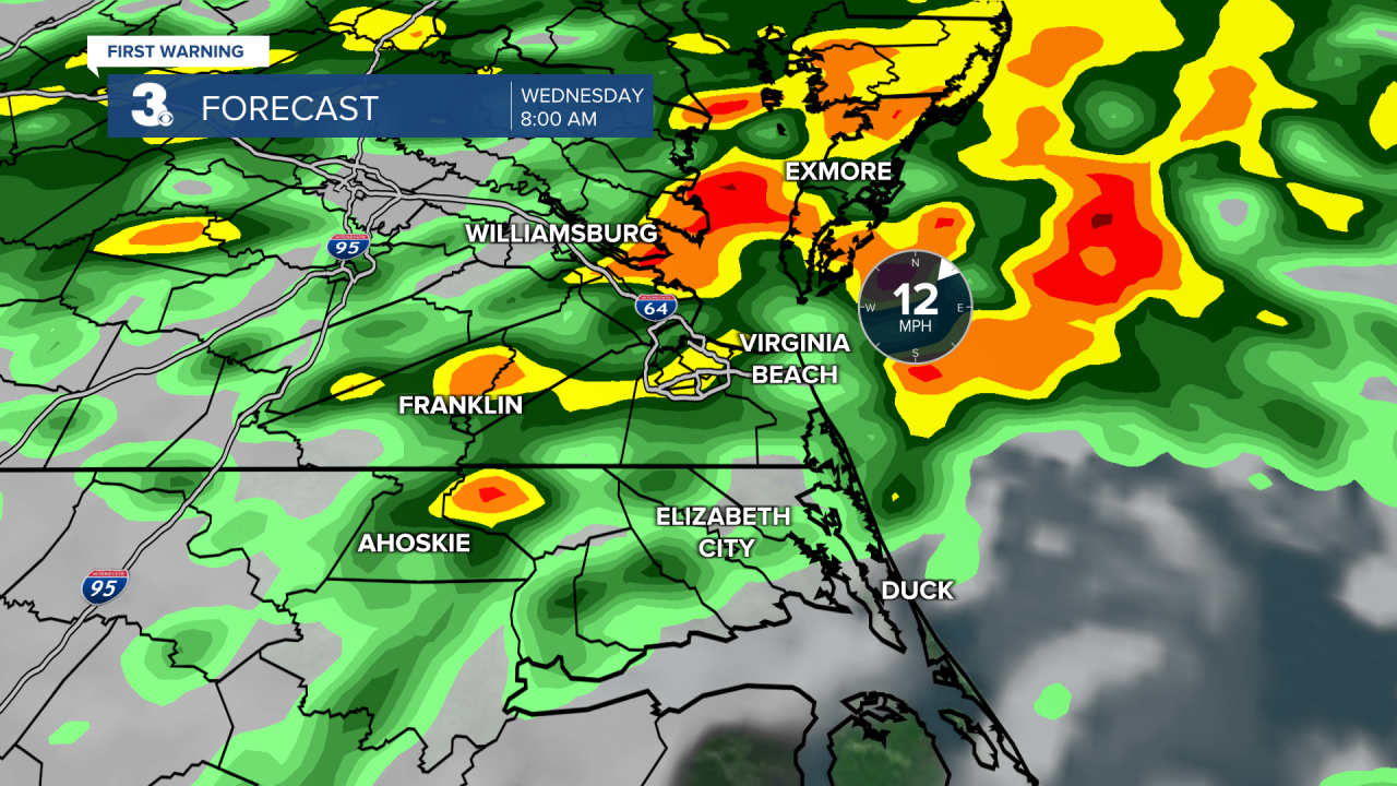
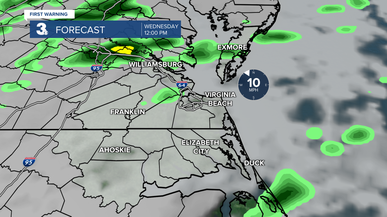
Rain will become more scattered around lunchtime and the rest of our Wednesday will be overcast and chilly with highs in the low 50s.
Speaking of temperatures, our below-normal trend continues into Thursday. Highs will only reach the upper 40s with overcast skies and scattered showers, especially late.
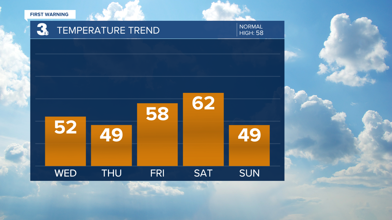
We are tracking a cold front that will bring us another round of rain Friday night to Saturday morning.
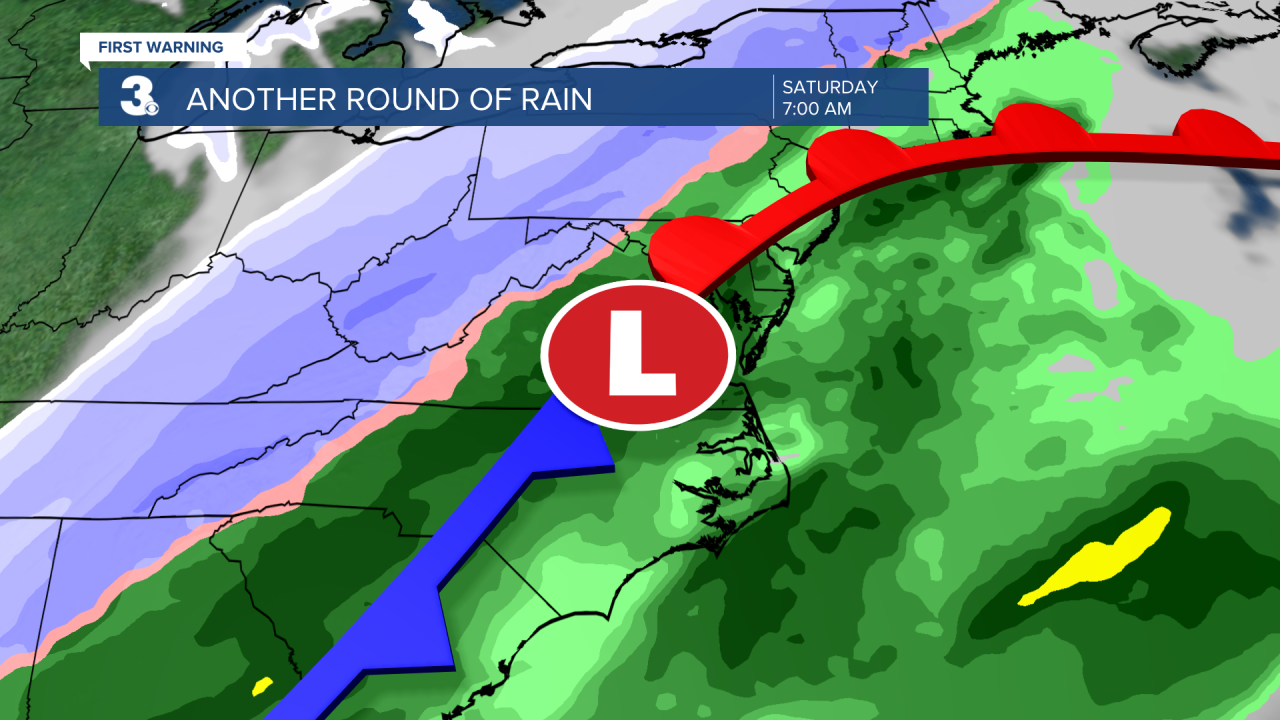
As it stands the Saint Patrick's Day Parade in Ocean View will be soggy with cloudy skies, rain and gusty southwest winds between 15 and 25 mph, with gusts up to 35 mph. Temperatures drop from the 60s on Saturday to the 40s on Sunday behind the cold front.

