



Meteorologist Tony Nargi's First Warning Forecast
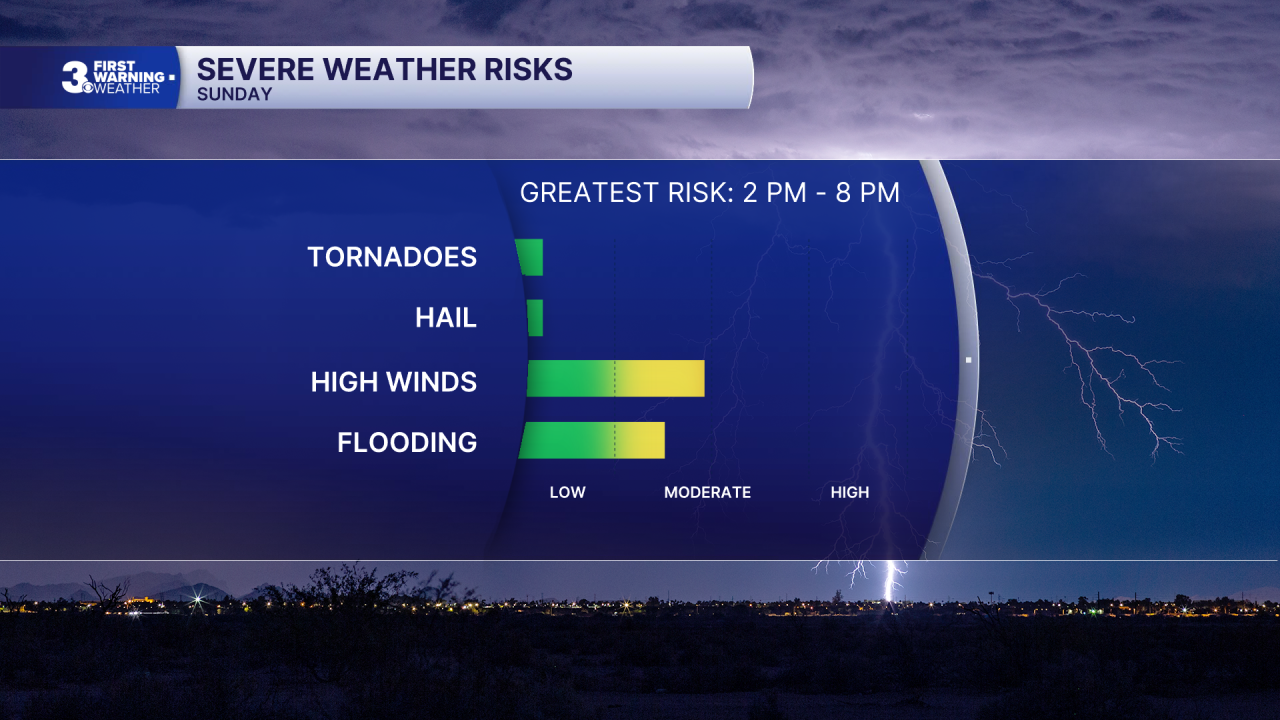
Today will start out hot and humid with some sunshine during the morning. High temperatures will reach the low 90s. There are no air quality concerns today. Winds will start out of the SW at turn NW at 10-15 mph. We'll see clouds and storms develop between noon and 2 pm. Storms will become widespread, with some severe storms capable of producing isolated wind gusts up to 70 mph. Showers and storms will taper off after 8 PM, with cloudy skies lasting overnight. Lows will be in the low to mid 70s.

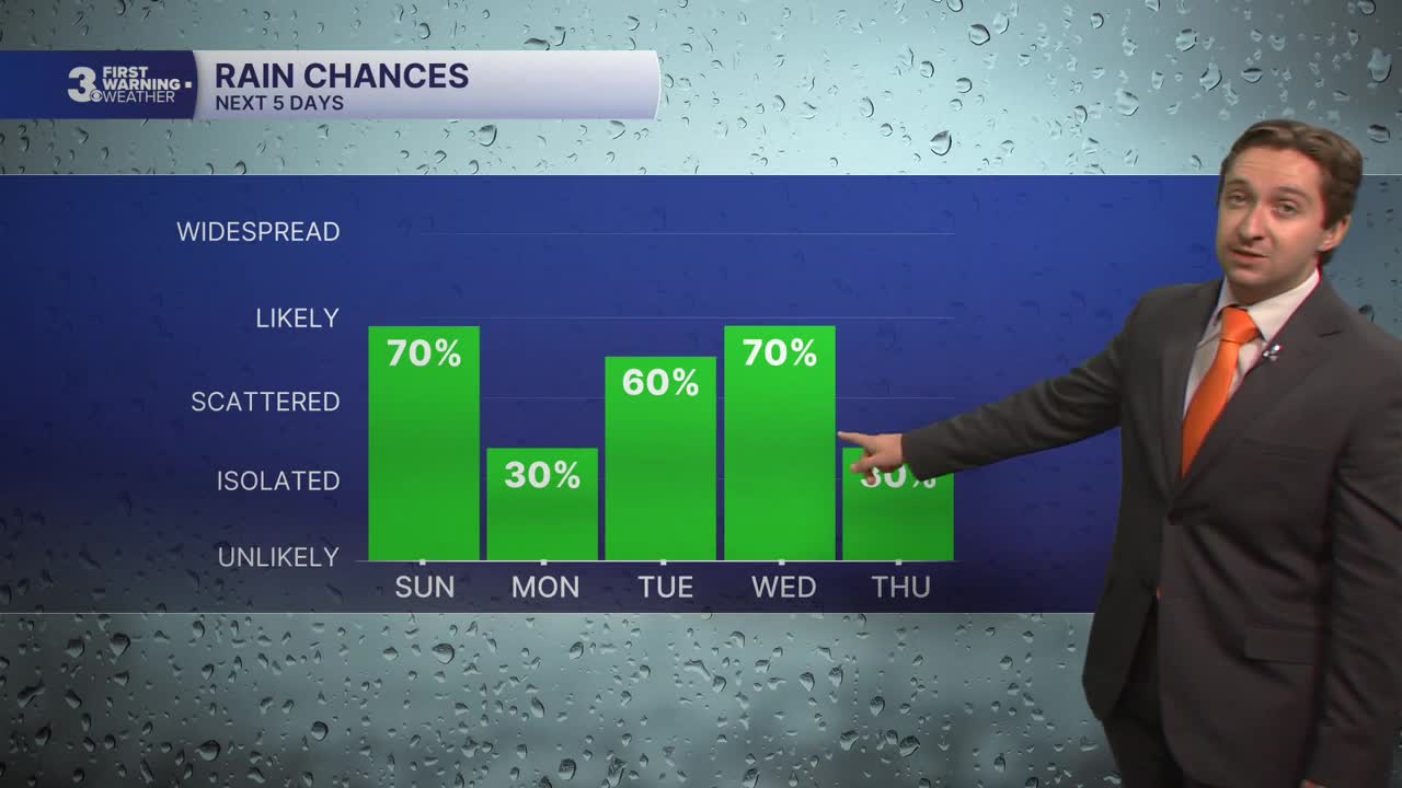
Tomorrow will start off with cloudy skies and isolated showers. High temperatures will only reach the mid 80s, with winds out of the NE at 5-15 mph. A few isolated thunderstorms will pop up during the afternoon, with a low-end chance of producing a severe storm in North Carolina. Most of us stay dry on Monday with only a 30% chance of rain, with the highest chance of seeing any storms south towards North Carolina.

Tuesday will be unsettled as well, with scattered storms popping up during the afternoon. There is yet another severe storm chance on Tuesday, particularly during the late afternoon. High temperatures will reach the low to mid 90s. On Wednesday, a cold front will push through the region, bringing yet another chance of storms with a severe threat Wednesday afternoon. Highs will reach near 90 degrees.

We'll finally get a break from all of the storms later this week, with just some lingering showers/storms Thursday morning finally clearing out by the afternoon. Friday and Saturday of this week look relatively dry, though uncertainty is a bit high almost a week out, and a stray shower/storm can't be ruled out.

TROPICS:
Invest AL91 off the west coast of Florida is expected to become a tropical cyclone by Monday, likely becoming Tropical Storm Bertha. The cyclone will likely track west towards Louisiana, and is unlikely to have any impacts in Hampton Roads.

Weather updates on social media:
