



Meteorologist Tony Nargi's First Warning Forecast
The hazy skies will stick around this evening with temperatures dropping into the low 80s. We'll see clear skies overnight and lows in the 70s.

Tomorrow will be another hot and hazy day, with wildfire smoke from Northern MN and Ontario continuing to spill into the Mid Atlantic. Smokey conditions should keep our temperatures from getting as hot as previously thought earlier this week, with high temperatures reaching the mid 90s (previously had Thursday around 100, before wildfires exploded). We'll see little cloud cover but lots of haze along with winds out of the SW at 5-10 mph. Overnight will be partly cloudy with lows in the mid to upper 70s.

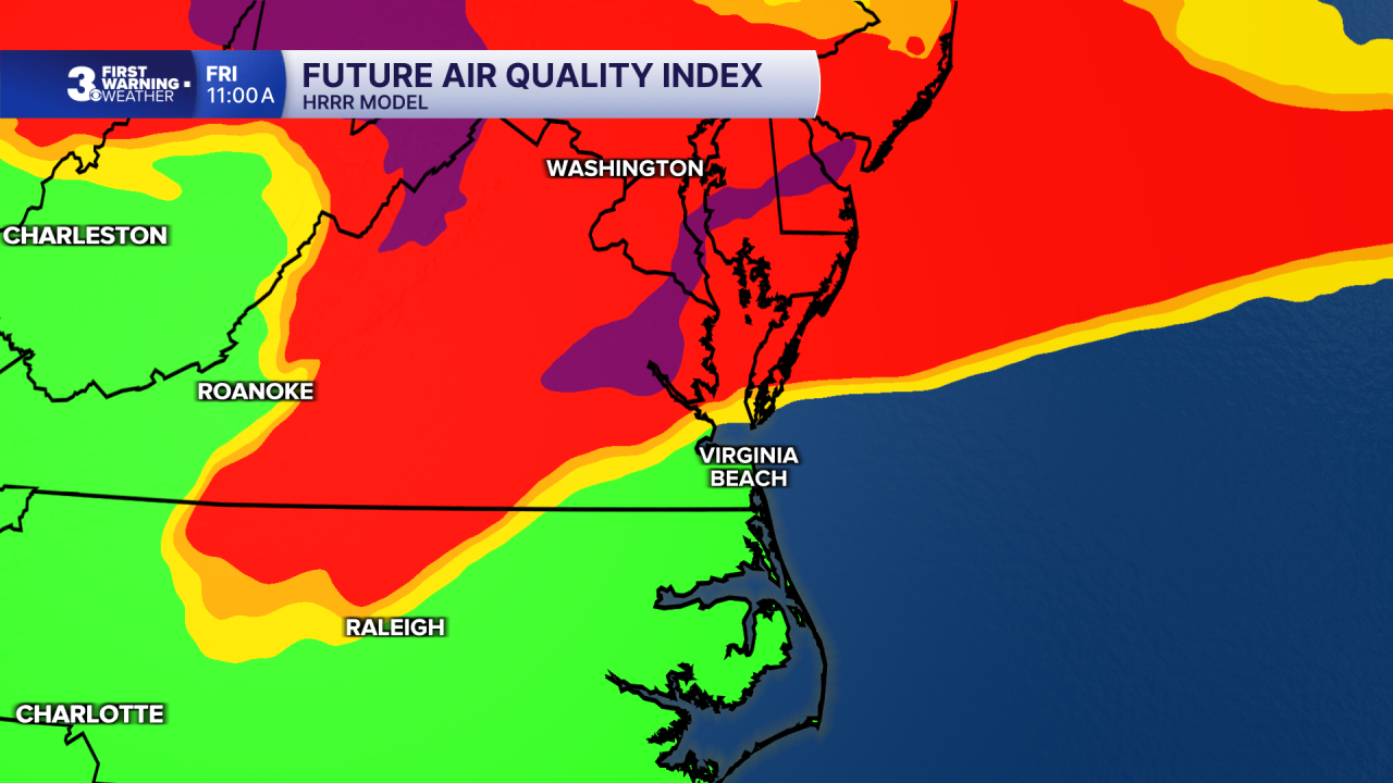
Friday will feature more wildfire smoke, and a passing front early Friday morning will help mix smoke from up in the atmosphere down to the surface. This will lead to air quality concerns for at least the Peninsulas and Eastern Shore, and potentially Southside and North Carolina by Friday afternoon as well.. An N95 mask is recommended when outside in poor air quality and try to reduce your time outdoors, especially if you have respiratory issues. We'll see high temperatures around 90 along with a breeze out of the NE at 10-15 mph.

This weekend we'll see a warm front move through, helping move some of the wildfire smoke out of Hampton Roads and bring some storm chances. Highs on Saturday will reach the mid 90s, and high humidity levels will lead to heat indices in the mid to upper 100s. Heat advisories may be necessary. A few storms are possible late in the day, after 6 PM through midnight. Sunday will be mostly cloudy with showers and storms, particularly during the afternoon. High temperatures will reach around 90.

Weather updates on social media:
