First Warning Forecast:
We're going to feel just shy of all 4 seasons this week. After a very cold Valentine's Day, the 40s, 50s, 60s and 70s sums up the rest of this week's temperatures.

Along with the dramatic warm up, weather will stay quiet thanks to High Pressure building through the middle of the week. This will lead to low rain chances through Thursday afternoon. After that, our weather pattern will change.

A system developing in the Pacific Northwest will take a dive south off the Colorado Rockies over the next few days. As it moves east it'll interact with the warm waters of the Gulf of Mexico which could bring severe weather to the Deep South Thursday afternoon. After that, early model guidance takes the center of the storm (and it's energy) north towards the Midwest which would take that threat of strong storms away from us here across the Mid Atlantic.

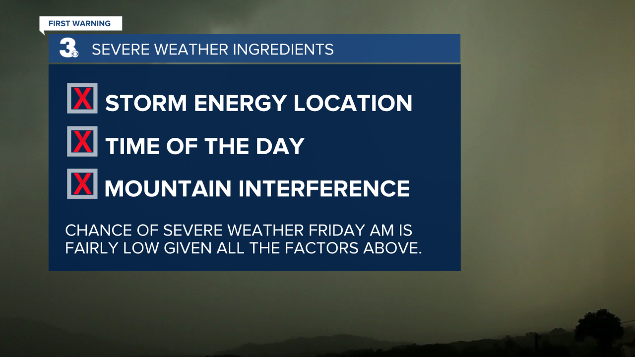
The question is...will we see rain Friday? Yes. Could we have thunderstorms? Perhaps. But will we see severe weather? At this point, no. Listed below is a few bullet points as to why we won't have the same threat of severe weather as our friends across Mississippi and Alabama. First, the storm energy will likely move north before getting a chance to move in our direction. Second, even if the center moves north, the cold front will move in early Friday when there isn't much diurnal energy to add fuel. And third, is the system's interaction over the Appalachian Mountains. We know all too well how even the 3,000 to 6,000ft elevation in North Carolina and Virginia can weaken systems as they move in our direction. We'll see how the models look tomorrow.