

Derrah Getter's First Warning Forecast
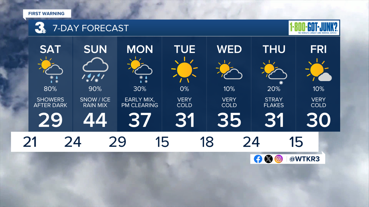
Friday is our “calm before the storm.” We’ll see mostly cloudy skies and a few spotty showers. Temperatures make a run for 50. Winds pick up overnight and temperatures drastically drop Saturday morning.

Partly sunny conditions will get us started Saturday morning but be prepared for dangerously cold temperatures. Wind chill values will be on either side of zero. More clouds build in Saturday afternoon with feels like temperatures in the teens and highs in the 20s and 30s.
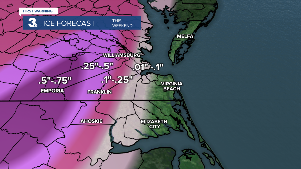
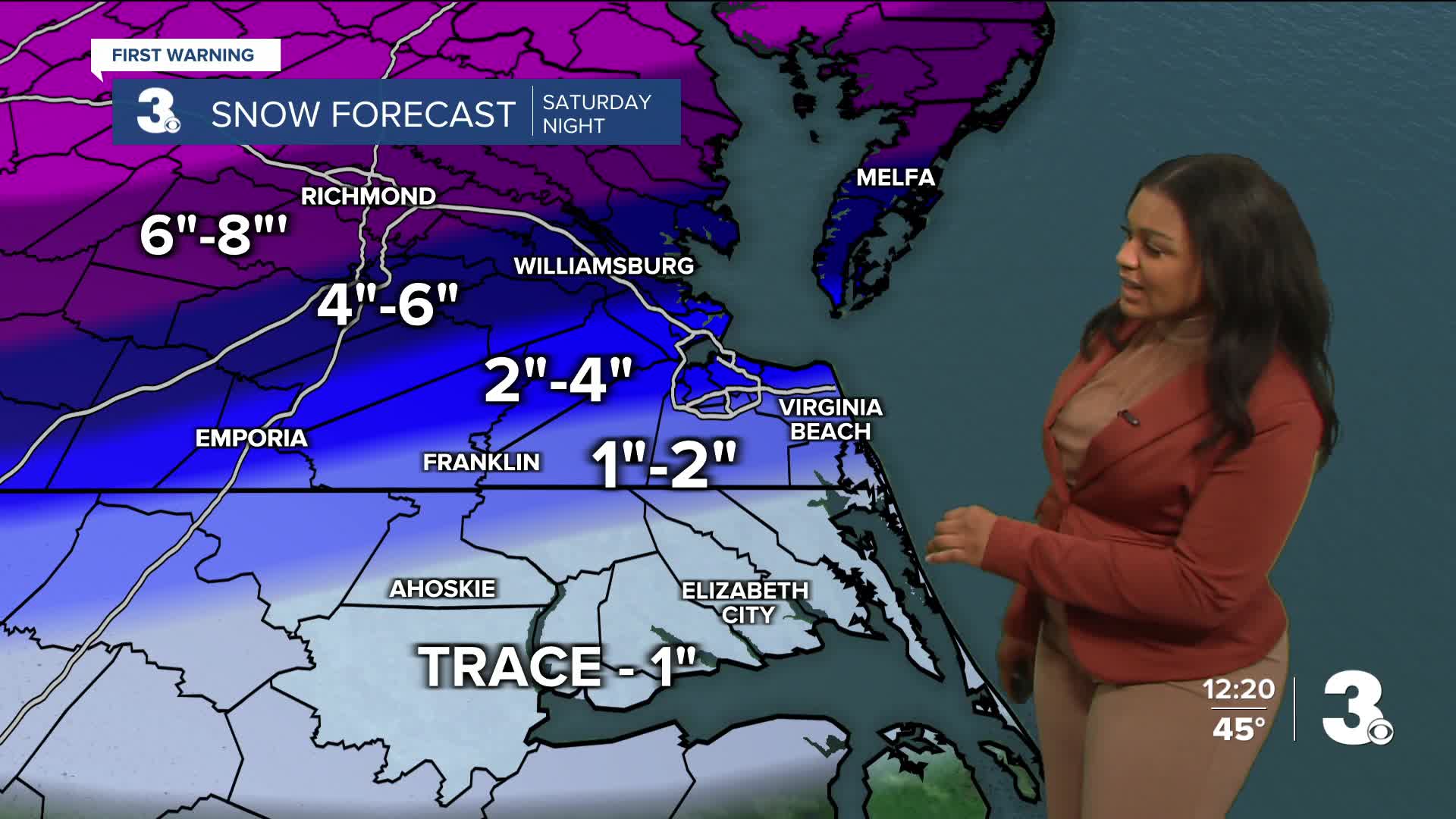
Snowfall begins Saturday night. Once the snow is all said and done, we’re looking at up to an inch from the Albemarle to Southside and up to eight inches for the Peninsulas. The snow makes the transition to sleet and freezing rain Sunday morning and eventually all rain. Locations that see less than five inches of snow will see any accumulation being washed away. Those with higher snowfall total amounts, primarily areas in the direction of I-95, will be at risk for some ice.
Temperatures will stay very cold next week with highs only in the 30s.
Let's connect on social media!
Forecaster Derrah Getter:
For weather updates on Facebook: HERE
For weather updates on X: HERE
Follow me on Instagram: HERE
Check out the Interactive Radar on WTKR.com: Interactive Radar
