

Meteorologist Tony Nargi's First Warning Forecast
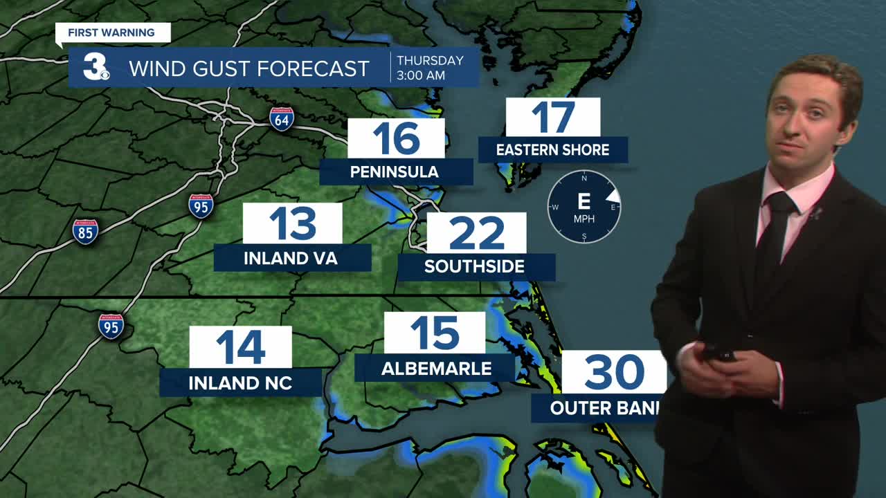
Tonight, temperatures will cool off into the 50s for many of us, with low 60s along the shoreline. Winds will be persistent out of the NE at 15-25 mph, with msotly clear skies expected.

Tomorrow will be pleasant with partly cloudy skies along with below normal highs in the upper 60s to low 70s. The winds will let up a bit, with NE winds at 10-20 mph. A stray (10% chance) shower is possible, but most will stay dry. Tidal flooding will be possible once again, with nuisance to minor tidal flooding expected during the morning and evening high tides. The surf will be rough, with 5 to 9 foot waves expected.

Friday will be excellent, with calmer winds out of the NE at 5-15 mph. Highs will reach the low 70s, with mostly sunny to partly cloudy skies expected. No tidal flooding is expected. Saturday will be great as well, with highs reaching the mid 70s along with light winds. We'll see mostly sunny skies this weekend, with low dew points leading to an amazing fall weekend!

TRACKING THE TROPICS
Humberto's remnants and category 2 Hurricane Imelda continue to move away, with better surf conditions and lighter winds expected by the end of the week. Behind the two storms that caused us the trouble this week, we can expect a nice quiet stretch in the tropics.

Weather updates on social media:
