

Meteorologist Tony Nargi's First Warning Forecast
Tonight, temperatures will drop into the 60s and winds are expected to pick up. We'll see winds out of the NE at 15-25 mph, with gusts up to 30 mph.

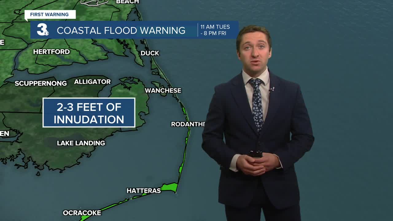
Tomorrow will be a windy day with persistent winds out of the NE at 15-25 mph, with gusts up to 35 mph. We'll see cloudy skies to start with some clearing expected in the afternoon. Strong winds out of the NE will lead to tidal flooding, with minor tidal flooding expected Wednesday afternoon. Highs will reach the low to mid 70s, with dew points dropping off into the mid to low 60s. Surf heights will be dangerous, with 6-10 feet of surf expected and a high risk of rip currents. A spot shower or patch of drizzle is possible, but it will be mainly dry.


Thursday will be breezy but not as bad, with winds out of the NE at 10-20 mph, gusts to 25 mph. More tidal flooding will be possible during the We'll see a decent amount of sunshine, with some partly cloudy skies expected during the afternoon. Highs will be cool, in the upper 60s and low 70s. Dew points drop into the 50s, bringing a crisp fall feel to the air. Friday will be excellent, with highs bouncing back into the 70s and much lighter winds out of the NE at 5-15 mph. We'll see mainly sunny skies.

This weekend should be lovely as well, with no chance of rain and plenty of sunshine. Highs return to normal on Saturday and Sunday reaching the mid to upper 70s.

TRACKING THE TROPICS
The dueling Hurricanes continue to move out to sea, with Hurricane Humberto and Hurricane Imelda both sitting at category 1 status right now.

Hurricane Humberto will dissipate rather soon, weakening rapidly and merging with Imelda over the open waters of the Atlantic by Thursday. Hurricane Imelda will maintain category 1 status as it moves towards Bermuda. These two systems will churn up plenty of rough surf, and a high risk of rip currents should be expected through the weekend. Once these two Hurricanes are gone, quieter days in the tropics lie ahead.


Weather updates on social media:
