


Meteorologist Tony Nargi's First Warning Forecast
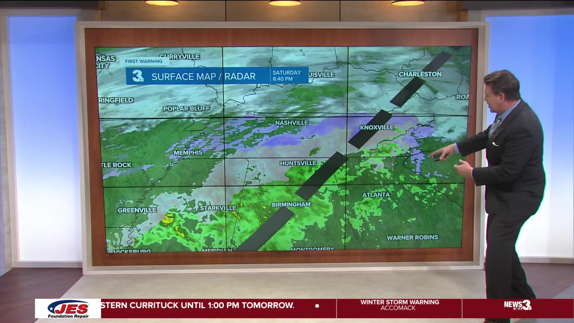
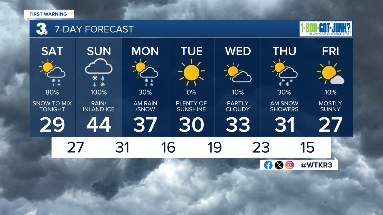
TODAY: We're tracking an impactful winter storm that will arrive tonight. Before the storm moves in, clouds will build on Saturday with very cold temperatures in the 20s and low 30s with winds chills in the teens and single digits. Overnight snow will arrive from west to east north of the Albemarle Sound after 7 pm.


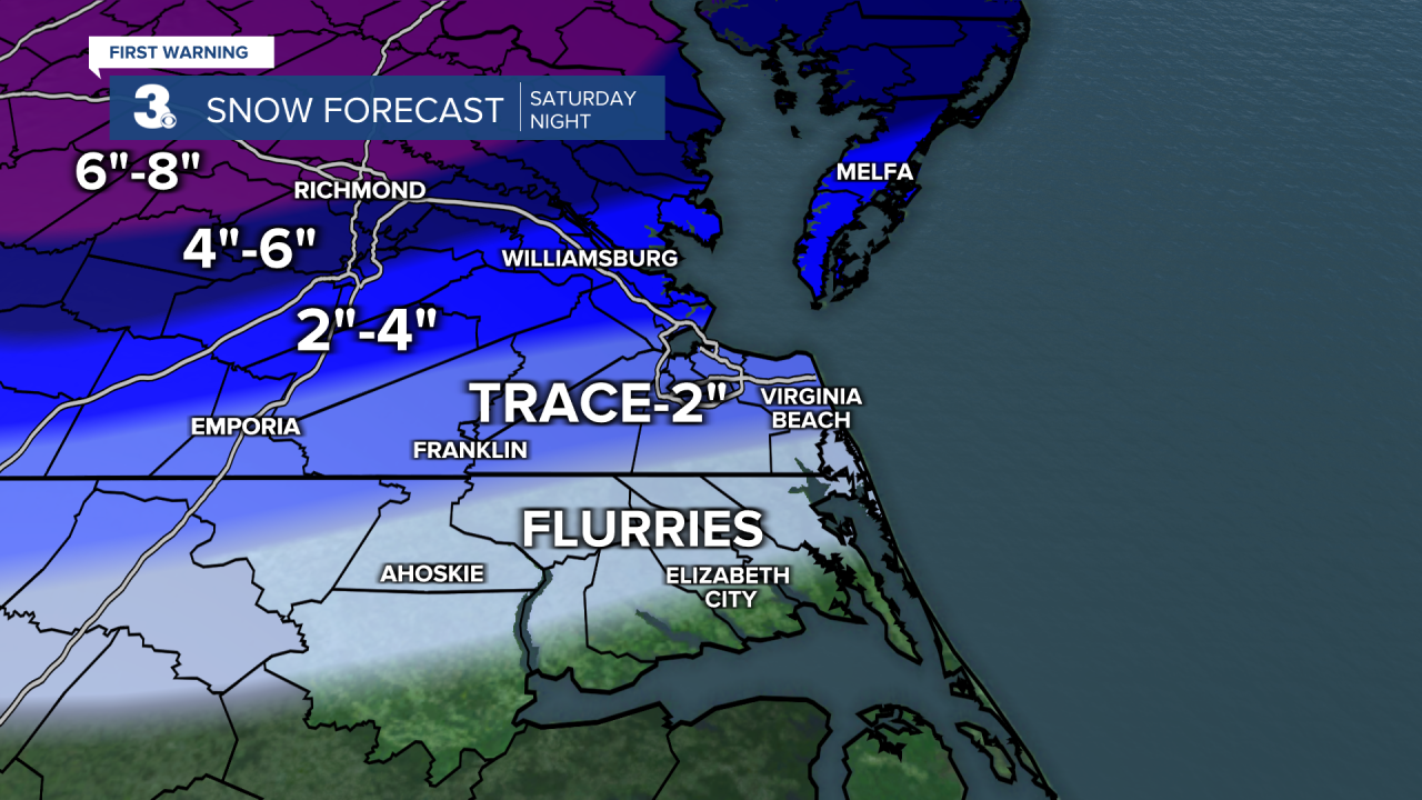
TONIGHT: Snow will begin to change over to sleet and freezing rain after midnight, with mainly rain expected for eastern areas after 7 am tomorrow morning as temperatures slowly get above freezing. Travel will be very difficult tonight in Hampton Roads, please avoid the roads unless it's an emergency. A Trace to 2" of snow and sleet is expected for Southside, with 2 to 4 inches of snow and sleet is expected for the Peninsulas and Eastern Shore. Heavier amounts are expected further north.
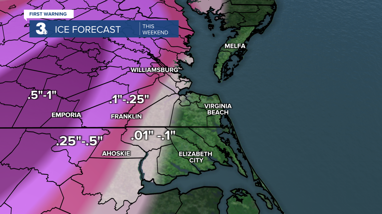
The biggest impact will be freezing rain, with major impacts expected for our western counties where up to an inch of ice accretion is possible through Sunday. That's enough to produce numerous power outages and make travel almost impossible. Winds will be out of the NE at 15-25 mph, gusting up to 35 mph at times.

TOMORROW: Tomorrow will be a windy and rainy day, with plain rain and temperatures in the 30s to mid 40s closer to the shoreline. Far inland areas in Northampton, Southampton, Sussex, and Surry counties along with Franklin and Williamsburg will see significant icing, especially during the morning hours. Those inland areas will see very difficult, if not impossible, travel where ice accumulates.
Further east where just plain rain falls, travel will be fine with rain helping to wash away Saturday night's snow and sleet. Precipitation will lighten up during the afternoon. Winds will be out of the NE at 10-20 mph. Overnight a line of showers and downpours will move through, with some snowflakes mixing in at the tail end as the storm departs. Temperatures will fall from the 30s and 40s into the 20s and low 30s by Monday morning.

LOOKING AHEAD: Monday will start out cloudy with some flurries or sprinkles possible early on. Icy roads will be the main issues on Monday morning, with patchy ice likely as Sunday's rain freezes up. Please use extra caution while traveling. Skies will clear by the afternoon, with highs in the mid to upper 30s. It will be windy, with winds out of the NW at 10-20 mph. By Tuesday very cold air locks in, with high temperatures in the 30s and upper 20s for the rest of the week. Thursday will be our next chance of precipitation, with some light snow showers possible during the morning.
Weather updates on social media:
