


Patrick's First Warning Forecast
Expect increasing clouds overnight as scattered light rain and/or drizzle moves in in from south to north across the area. Our northern locations on the Peninsulas and the Eastern Shore, will have a chance of seeing a little freezing rain early before temperatures rise above the freezing mark everywhere overnight.

We aren't expecting widespread ice accumulation, but a light glaze on top of car windshields will be possible. Temperatures will warm to the mid 40s by sunrise on Wednesday.
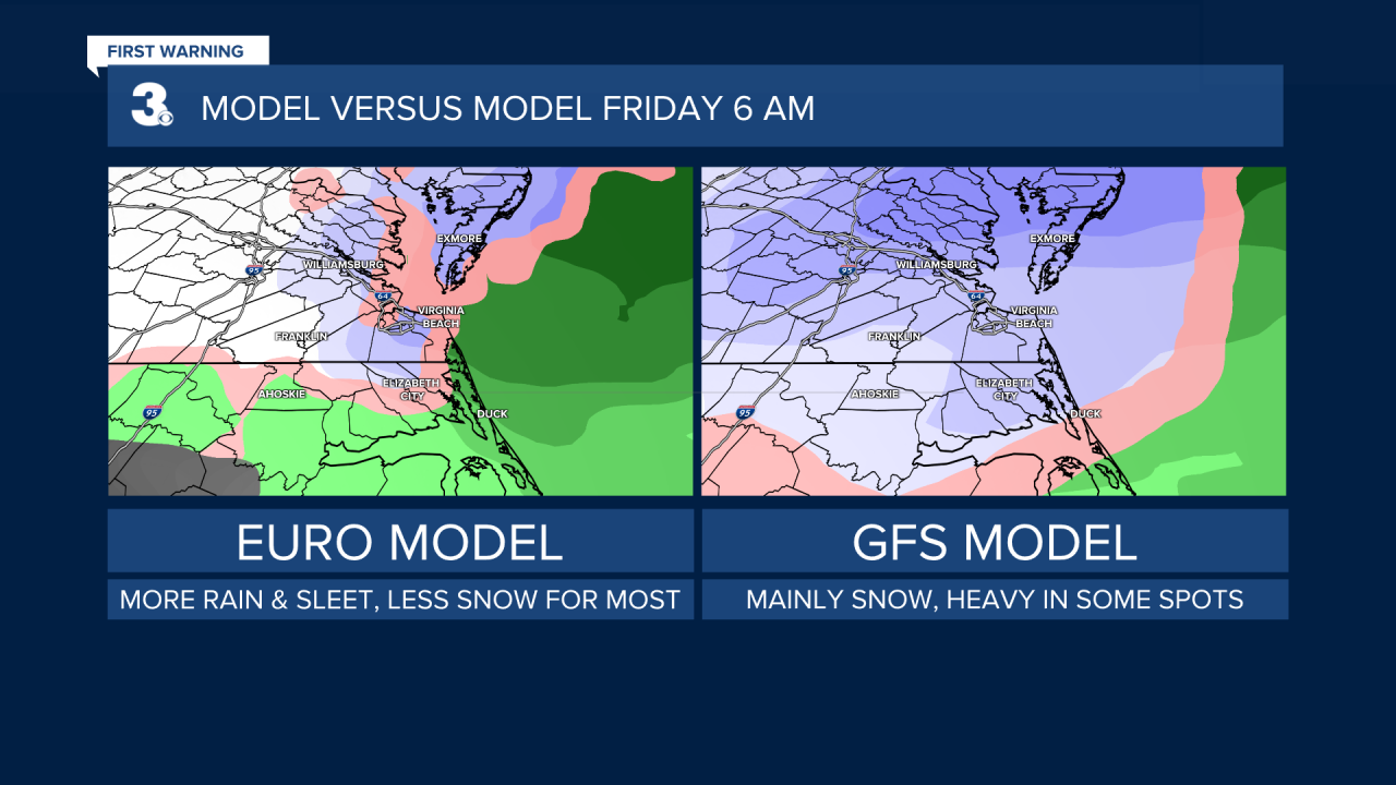
Our attention then shifts to our next weather maker set to move in Thursday night into Friday morning. Weather models continue to disagree on the exact movement and location of the storm, which will impact the type of precipitation we see. But at least some snow is showing up on all the major forecast models.
As a system moves in from the south, we expect some snow to spread across the region from very late Thursday night to very early on Friday morning. So how much?
Our in-house GRAF forecast model is painting in from 1/4 to 3/4 of an inch.

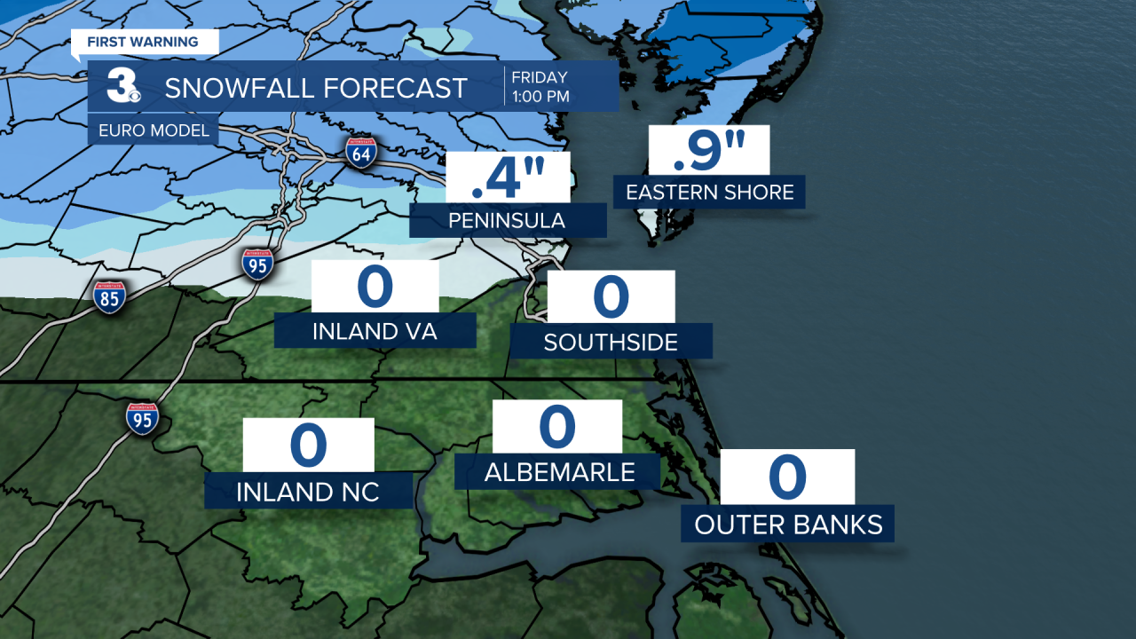
The European forecast models is keeping most of the impact to our north and west, painting in measurable snowfall only on the Peninsulas and Eastern Shore.
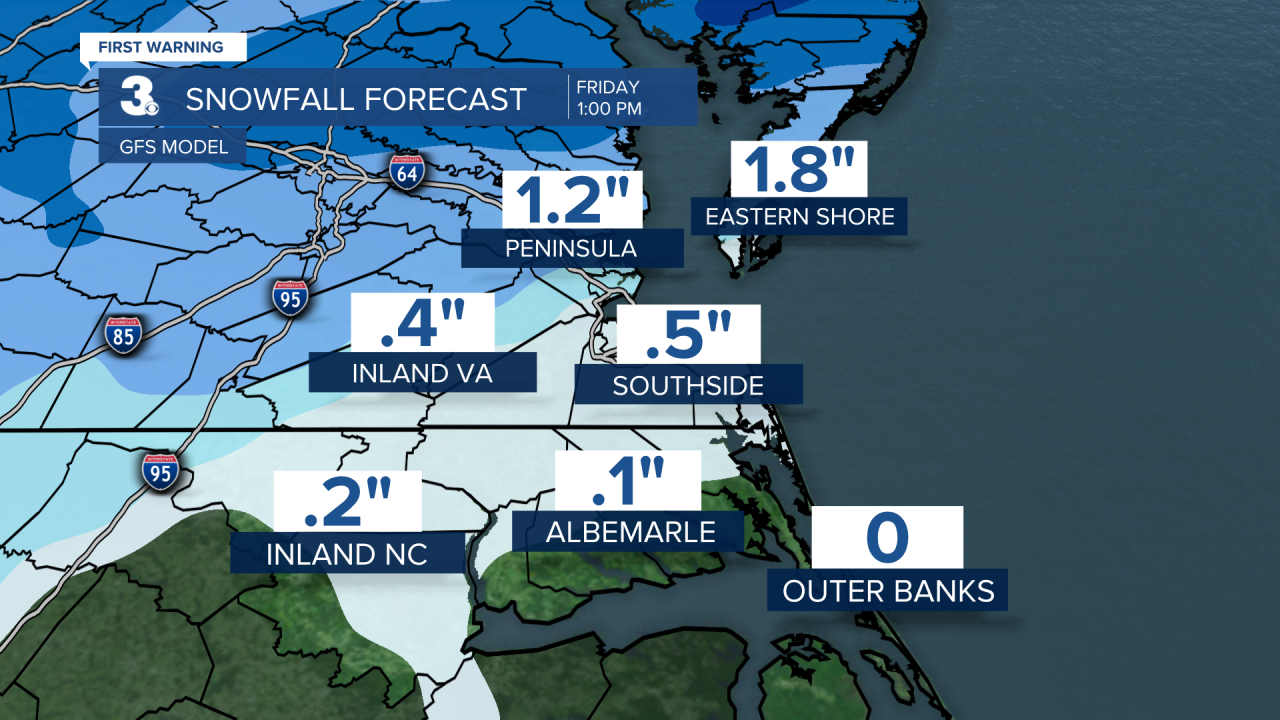
Meanwhite, the GFS model is the most aggressive showing nearly two inches of snow in some parts of the region.
We're hoping to see the models come into better agreement over the next few days. Stay tuned!
