


The latest update on Hurricane Erin
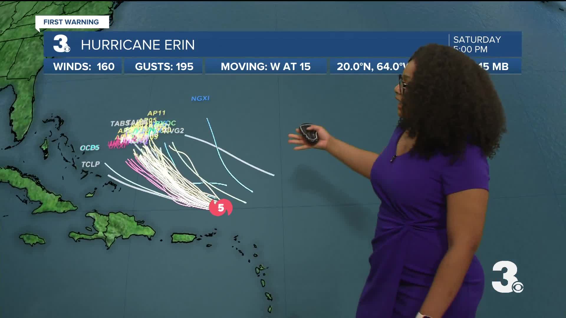
SATURDAY EVENING UPDATE: Hurricane Erin is currently a Category 4 hurricane.
11 PM UPDATE:
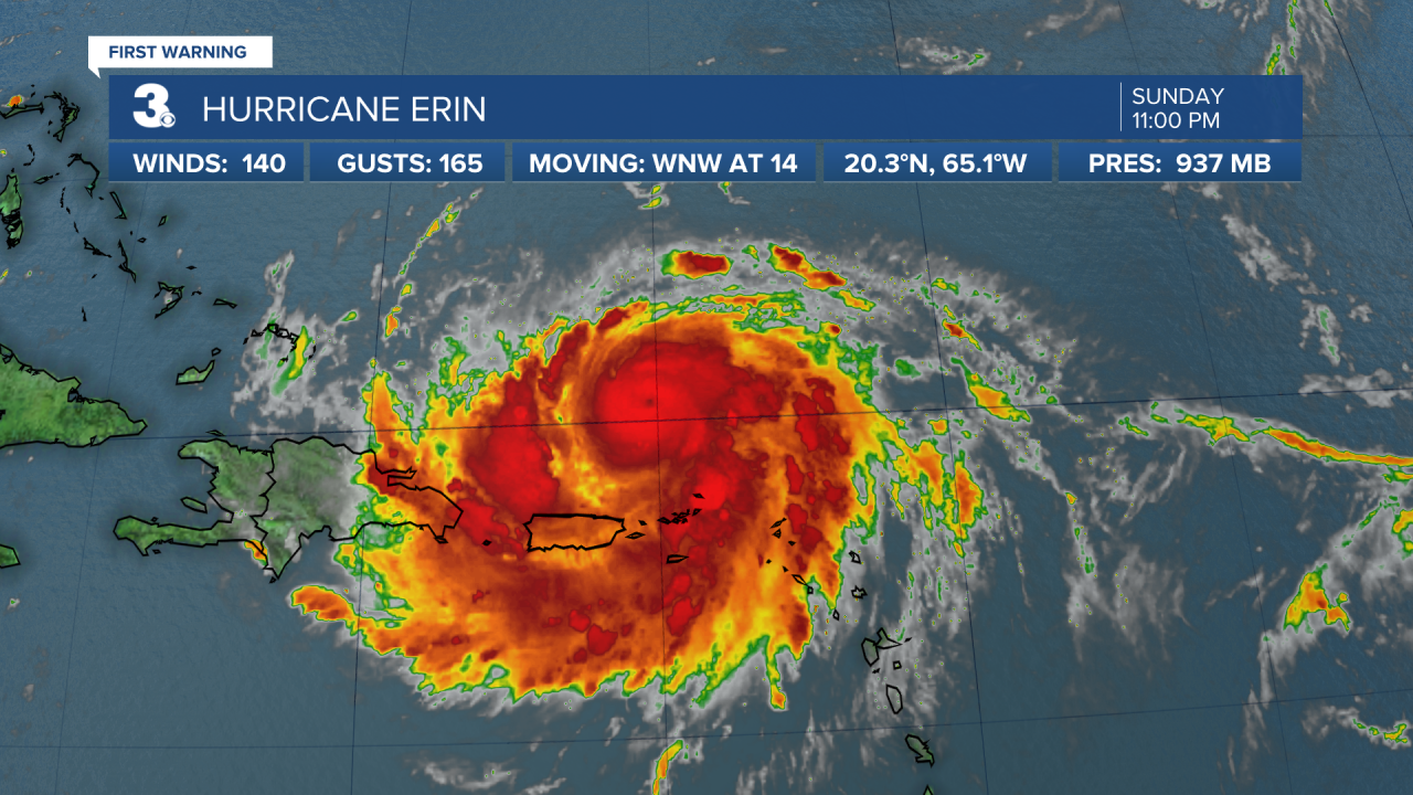
As Erin undergoes eyewall replacement, it has slightly decreased in strength. Once a new eye emerges, Erin is expected to double and even triple in size leading to rough surf along the Atlantic coast.

Hurricane Erin is expected to maintain major hurricane status for the next few days. Models are in strong agreement that there will be a strong northeasterly turn however some models have nudged its path a little closer to the west.

Erin is still on track to make a sharp turn to the north later this weekend, with the current forecast having the storm "split the uprights" as we call it in the tropics, meaning it is expected to pass between Bermuda and the east coast of the US, avoiding major landmasses. Right now a direct impact is unlikely for our area. Breezy conditions are also expected thanks to Erin's presence offshore later next week, along with a high risk of rip currents.

