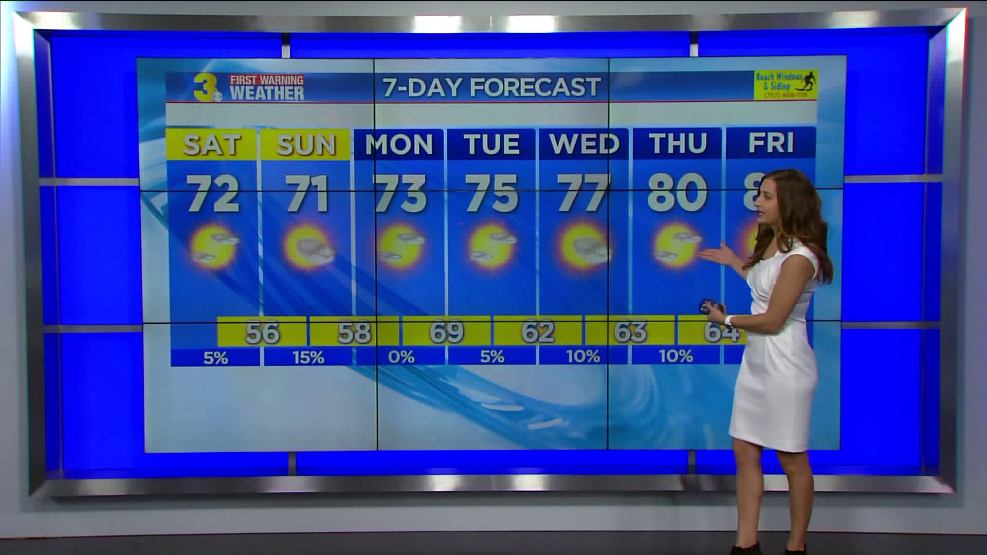
Lows dropping into the upper 50s. Rain chances continue to remain slim. A few clouds will mix in tonight for North Carolina as another cold front crosses the area bringing cooler temperatures for the weekend.
A gorgeous weekend in store! Highs in the lower 70s, some communities may not make it out of the 60s. Expect plenty of sunshine. Looking like great weather for the Neptune Festival. It will still be a bit breezy with N/NE winds at 5 to 15 mph.
Still looking dry for next week. Highs will slowly climb into the mid and upper 70s.
Tonight: Partly cloudy and cool. Lows in the upper 50s. Winds: SE 5-10 mph.
Tomorrow: A nice mix of sun and clouds. Highs in the low 70s. Winds: N 5-15 mph.
Tomorrow night: Mostly clear, cool and breezy. Lows in the mid and upper 50s. Winds: N10-15, with higher gusts.
Weather & Health
Pollen: Low-Moderate (Ragweed, Sagebrush)
UV Index: 6 (High)
Air Quality: Good (Code Green)
Mosquitoes: Very High
Tropical Update
Maria is racing across the north Atlantic. Maria is centered about 560 miles S of Cape Race Newfoundland and moving ENE at 31 mph. This motion is expected to continue during the weekend. Maximum sustained winds are near 60 mph with higher gusts. Maria is expected to acquire extratropical characteristics Saturday night.
11:00 PM AST Fri Sep 29
Location: 38.6°N 53.9°W
Moving: ENE at 31 mph
Min pressure: 988 mb
Max sustained: 60 mph
Lee is centered about 925 miles WNW of the Azores ENE at 41 mph. Maximum sustained winds have decreased to near 60 mph with higher gusts. Some weakening is forecast for the next 24 hours, and Lee is expected to dissipate on Saturday.
11:00 PM AST Fri Sep 29
Location: 44.3°N 42.8°W
Moving: ENE at 41 mph
Min pressure: 998 mb
Max sustained: 60 mph
A weak low pressure area over the southern Florida Peninsula is interacting with an upper-level low to produce a large but disorganized area of cloudiness and showers extending from the northwestern Caribbean Sea northward through the Florida peninsula. Environmental conditions appear to be marginally conducive for some additional development before the upper-level winds become unfavorable early next week.
* Formation chance through 48 hours: Medium (40%)
* Formation chance through 5 days: Medium (40%)
We are tracking a tropical wave over the northeastern Caribbean Sea and the adjacent Atlantic waters. Although there are no signs of organization, conditions could become a little more favorable for some development next week while the system moves toward the WNW.
* Formation chance through 48 hours: Low (0%)
* Formation chance through 5 days: Low (20%)
Hurricane Tracker
For weather updates on Facebook:HERE
Follow me on Twitter: HERE
Follow me on Instagram: HERE
Check out the Interactive Radar on WTKR.com: Interactive Radar
Click here to sign up for email alerts from the First Warning Storm Team.


