HAMPTON ROADS, Va. – It’s the calm before the stor as public works crews were out in Norfolk and Virginia Beach clearing storm drains as the possibility for severe weather looms.
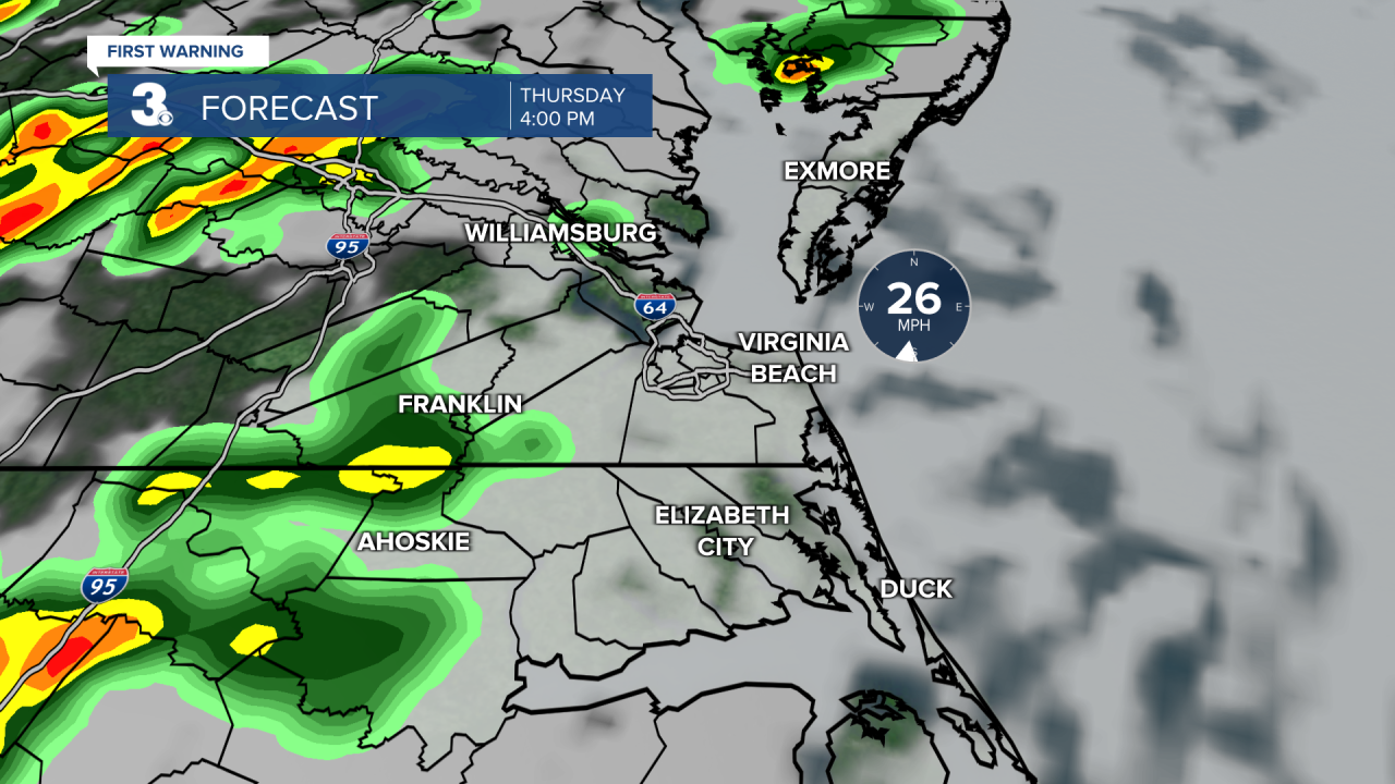
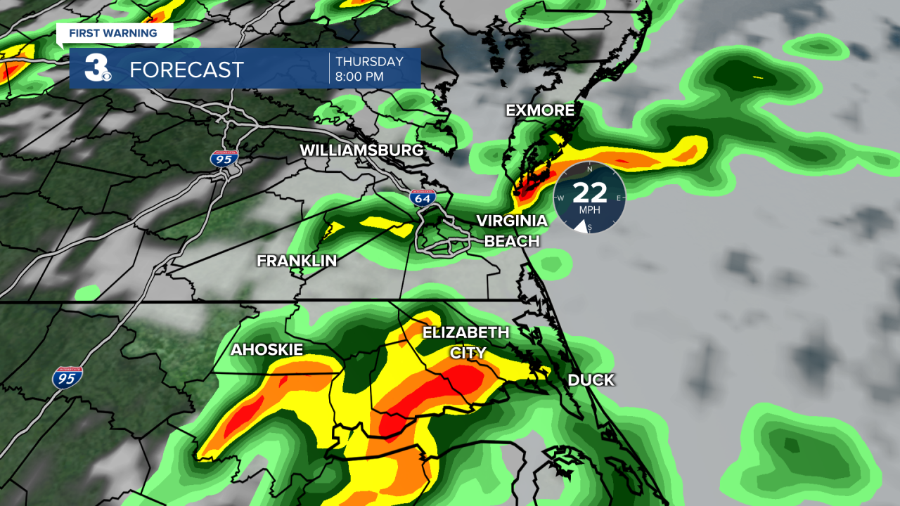
According to News 3 meteorologist April Loveland, the biggest threats will be wind, heavy rain, and hail. Hampton Roads is likely to see severe weather Thursday between 4 p.m. and midnight.
Winds picked up into Thursday and are expected to be strong throughout the day with gusts 40-60 mph by the evening hours.
Homeowners are advised to secure any loose outdoor objects that could become a danger if blown by the wind.
“This is the time of year you want to get out and start assessing your trees. You know, usually if you go out in your yard and you’re playing around, you don’t look up. But look up. You got to assess for broken branches, anything hanging from hangers because we’ve had a lot of wind storms lately," Owner of A Sailor's Saw, Joshua Holcomb said.
Holcomb's crew was in Virginia Beach Wednesday afternoon. He told News 3 pruning your trees allows the wind to blow through more easily, resulting in less damage to the tree or your home during storms.
Off Pleasure House Road in Virginia Beach, we also caught up with a public works crew clearing storm drains. They are were checking low-lying areas that are prone to flooding.
Mark Binshtok, president of Mr. Fix-It also said checking gutters is important. "Go out and just look. Make sure the gutter is fastened against the house and make sure that the downspouts, the gutters aren’t clogged that the downspouts when they come down are pointed away and that when the water comes away, it’s going to keep rolling away from the house," he said.
If you experience a power outage, you can call and report that to Dominion Energy at 866-366-4357 or click here.
As of Thursday morning, here is a timeline of when the storms may be the worst in your area: