


Meteorologist April Loveland's First Warning Forecast

Here are some of Norfolk's Easter Sunday extremes. We aren't looking to break any of these records today!

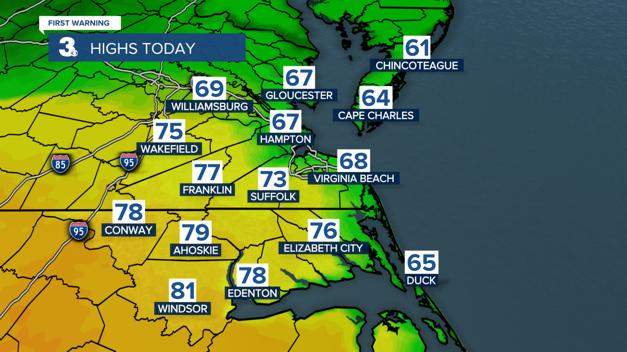
If you're heading out for any Easter activities, the earlier the better today. A frontal system is draped over the area, keeping us unsettled and giving us a big temperature spread. Depending on where you're headed today, you could have highs in the low 60s or near 80.
Showers and storms will develop this evening. A few heavy downpours will be possible along with small hail.


The unsettled weather pattern will stick around through midweek. Monday will be mostly dry, but we'll see more clouds than sunshine. Temperatures will warm to near 80 degrees. A few showers will be possible late.
Better chances for showers and storms on both Tuesday and Wednesday as a cold front approaches and crosses the area. Highs on Tuesday will be in the mid 70s and then the upper 60s on Wednesday.

The cold front will not only bring wet weather, but will bring a big drop in temperatures.
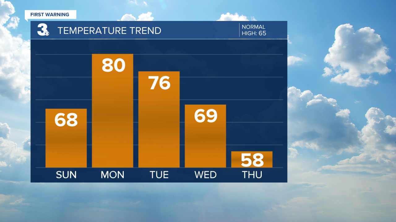

Once we get past Wednesday, temperatures will trend in the 50s, which is below normal for this time of year. The weather is looking dry and breezy with partly to mostly sunny skies.

Meteorologist April Loveland
For weather updates on Facebook: HERE
Follow me on Twitter: HERE
Follow me on Instagram HERE
Check out the Interactive Radar on WTKR.com: Interactive Radar
