


Meteorologist April Loveland's First Warning Forecast
A few degrees milder for Father's Day and the First Day of summer with highs in the 80s to near 90. There is a chance a few showers and storms, but not a washout. Just keep and eye on the sky. The best chance for stronger storms will be in northeast North Carolina. Summer arrive at 11:32 PM EDT.
A Tropical Storm Warning is in effect for, Little River Inlet to Duck, North Carolina, Pamlico and Albemarle Sounds. Right now, impacts appear limited. Winds 39 mph to 57 mph are possible, but forecast is looking closer to 15-25 mph, with 35 mph gusts. The rainfall forecast up to 1 inch. Tornadoes will be possible. Claudette will track south of the area late tonight and Monday morning. We will start to see the leading edge of some tropical moisture after 2-3 pm in North Carolina.
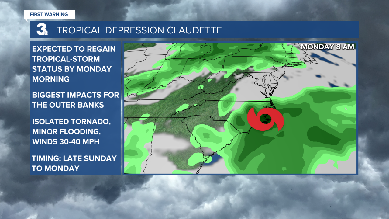
Temperatures on Monday will warm near 90. Expect scattered showers and storms, especially the first half of the day. The best chance for rain will be along the coast. Claudette is forecast to regain tropical-storm strength by Monday morning. The Outer Banks will have the biggest impacts including isolated tornadoes, minor flooding and gusty winds. Claudette will move offshore Monday afternoon.
A cold front will move through Tuesday bringing more showers and storms, especially during the afternoon. Some storms could be strong to severe. The Storm Prediction Center has the area under a level 1 for severe storms. The biggest threat will be damaging wind gusts. Temperatures will warm to the mid 80s.
Much drier and cooler behind the cold front. High temperatures on Wednesday will struggle to get out of the 70s.
Another dry day on Thursday. Expect mostly sunny skies and highs near 80 degrees.
Tropical Update:
A Tropical Storm Warning is in effect for:
* Little River Inlet to Duck, North Carolina
* Pamlico and Albemarle Sounds

Located about 15 miles ENE of Atlanta, Georgia and about 335 miles W of Cape Fear, North Carolina. The depression is moving toward the east-northeast near 17 mph. An east-northeastward to northeastward motion with some increase in forward speed is expected over the next couple of days. On the forecast track, the system should continue to move across portions of the southeastern U.S. through tonight, move over the coast of North Carolina into the western Atlantic Ocean on Monday, and pass near or just south of Nova Scotia on Tuesday. Maximum sustained winds remain near 30 mph, with higher gusts. Some re-strengthening is expected tonight, and Claudette is forecast to become a tropical storm again late tonight or early Monday over eastern North Carolina. Claudette is expected to become a post-tropical cyclone by late Tuesday.
Weather & Health
Pollen: Low-Medium (Grasses)
UV Index: 10 (Very High)
Air Quality: Good (Code Green)
Mosquitoes: Very High
Meteorologist April Loveland
For weather updates on Facebook: HERE
Follow me on Twitter: HERE
Follow me on Instagram HERE
Check out the Interactive Radar on WTKR.com: Interactive Radar
