


Meteorologist Kristy Steward's First Warning Forecast
Happy Friday evening! We really noticed the temperature drop today! Highs were 15-20° cooler than yesterday. Temperatures get even cooler this weekend with another cold front passing through.
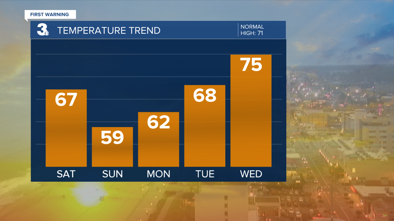
This evening, we could have a few spotty showers, but most areas look to stay dry. More spotty showers are possible Saturday morning and early afternoon. High temperatures Saturday will be in the middle 60s.
Sunday gets even cooler with high temperatures in the upper 50s. Sunday afternoon and evening, scattered rain showers move through. Showers could start in the mid-morning hours across northeastern North Carolina.

We dry out for the workweek and get to enjoy the return of plentiful sunshine. However, temperatures remain below-average for much of the week. Expect the low 60s Monday jumping to the upper 60s Tuesday and mid 70s Wednesday. Then, temperatures drop back down to the low to mid 60s for the end of the workweek.
At least pollen counts will be lower for a few days.

Connect with Meteorologist Kristy Steward:
FACEBOOK
X
INSTAGRAM
