


Meteorologist Kristy Steward's First Warning Forecast
Good Sunday night! A cold front is bringing us strong storms into tonight and a cooling trend for the workweek.
It has been an active evening, especially for the Peninsulas and Eastern Shore. Numerous reports of trees down and power outages from these strong storms booking it east at 55 MPH. Storms will quickly move through the rest of Hampton Roads and northeastern North Carolina the rest of this evening into tonight.

Late tonight, these storms and clouds will clear out. We should be dry by the morning commute. Monday will be a mostly sunny day and a little cooler with highs in the low 80s. Temperatures remain on a cooling trend majority of the workweek.
Highs in the upper 70s Tuesday, low 70s Wednesday, and many of us not even touching the 70° mark Thursday. The first half of the week looks mostly dry with plenty of sunshine.
Heading into the weekend, things will take a turn. Both our temperatures and rain chances will increase as we’ll likely see remnants from Ian. Expect scattered to widespread rain showers and lots of cloud cover Friday through Sunday. Temperatures will gradually rise into the mid to upper 70s for the weekend.

Tropical Update:
Tropical Storm Ian is located 160 miles S of Grand Cayman and is moving NW at 12 MPH. It has sustained winds of 60 MPH. Ian is forecast to strengthen into a category 4 hurricane as it clips the western part of Cuba, then it will track through the Gulf and turn toward a landfall along the Florida panhandle as a category 2 hurricane. It is expected to produce significant wind and storm surge in western Cuba and likely tropical storm conditions in the Florida Keys. Beyond that, it looks like Ian will travel inland along the East Coast and its remnants will likely bring us rain Friday through the weekend.

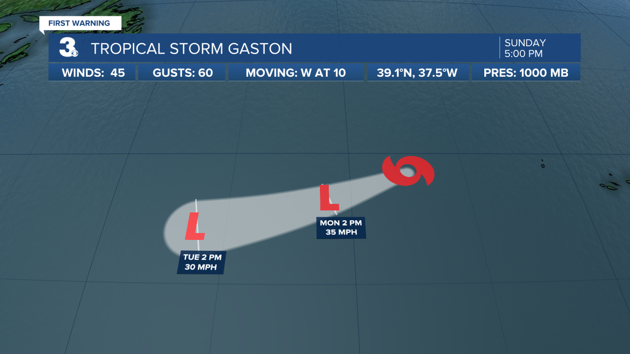
Tropical Storm Gaston is 475 miles W of Faial Island in the Central Azores. It's moving W at 10 MPH with 45 MPH sustained winds. Gaston is moving away from the Azores and weakening. It should soon dissipate in the Atlantic.
There is one other area being watched for development in the middle of the Tropics. It has a 30% chance of formation in the next 5 days.
Connect with Meteorologist Kristy Steward:
FACEBOOK
TWITTER
INSTAGRAM
