


Meteorologist Kristy Steward's First Warning Forecast
Happy Thursday evening! It was finally a nice warm day to be outdoors! High temperatures soared into the upper 70s and low 80s from gusty southwest winds. Temperatures will stay warm for most areas the next couple days ahead of a cold front. Rain chances start to go up a bit too.
Tonight stays warm and windy. Lows drop into the low 60s, which is where our highs should be this time of year. Tonight stays dry with passing clouds.
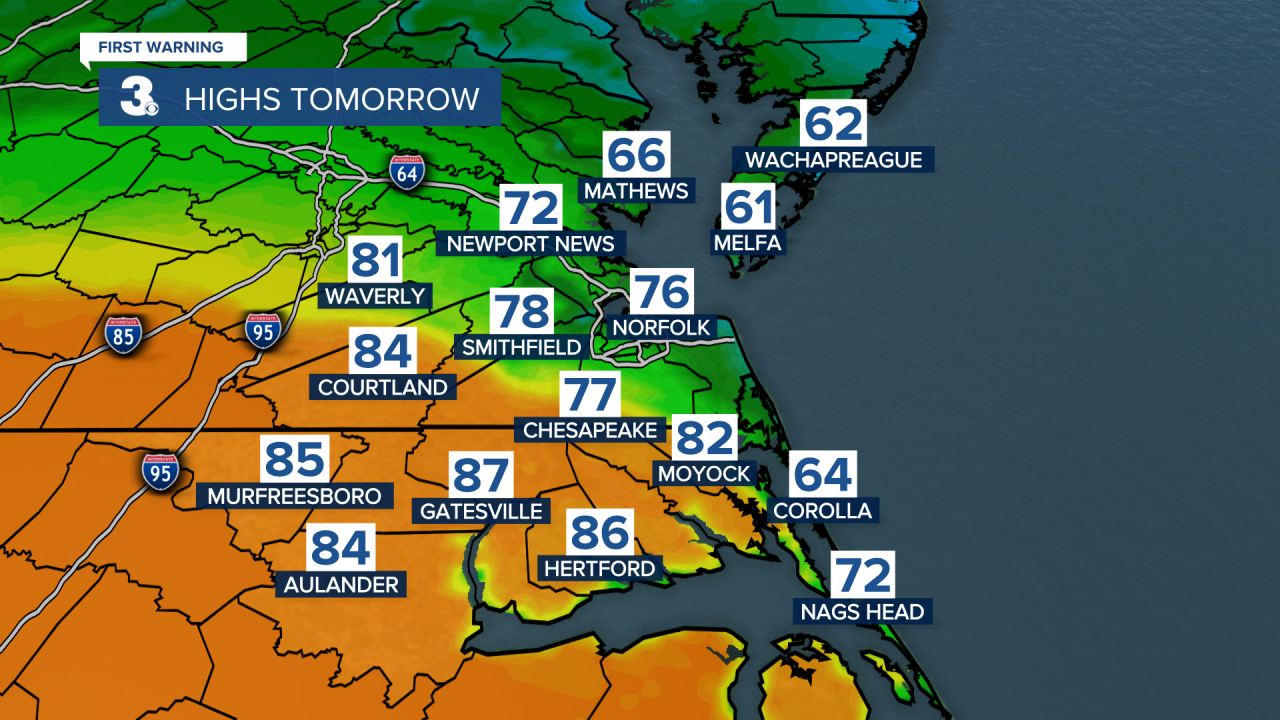
Friday will have more clouds than sunshine and a big temperature gradient. A cold front will approach, partially pass through Hampton Roads, then stall out near the NC/VA border. So, high temperatures will be quite variable. Highs in the low 70s for our northern communities, mid 70s across Southside, and we could even soar into the mid 80s across much of northeastern NC. So, if you don’t like the temperature where you are, you’ll be able to drive an hour or two north or south and find your preferred weather!
Around that frontal boundary, we could see some isolated showers. Our northern communities have a better shot at seeing those showers Friday afternoon and evening.
This stationary boundary lifts north as a warm front Saturday morning, helping us all see uniform high temperatures in the upper 70s Saturday afternoon. Winds will stay breezy. Late Saturday night, a cold front will push through and start cooling us down. Between those fronts, we have the chance at seeing isolated to widely scattered showers Saturday afternoon and evening.
Behind this system, high temperatures will be around 70° Sunday with a mix of sun and clouds and lighter winds.

A couple disturbances could bring us spotty showers Monday and Tuesday. Temperatures will also continue to drop throughout the first half of the workweek. Highs on Monday around 60° drop to the mid-upper 50s Wednesday. High temperatures rebound to the more seasonable low 60s next Thursday.

Connect with Meteorologist Kristy Steward:
FACEBOOK
TWITTER
INSTAGRAM
