


Meteorologist April Loveland's First Warning Forecast

Another day of below-normal high temperatures. Expect highs in the low 50s, which is about 10 degrees below-normal for this time of year. Clouds will come and go throughout the day. A cold front will move in, but we won't see any rain. We will however, see a drop in temperatures on Sunday.
After another chilly start in the 30s, temperatures will be on the cold side Sunday. Highs will only warm to the mid 40s. It will also be on the breezy side, making temperatures feel a bit cooler.
Clear skies Sunday night means a frigid start on Monday. Temperatures will plummet into the 20s! Brr!
Make sure you bundle up before you head out the door Monday morning. Temperatures will warm to the low 50s by the afternoon. Skies will be mostly sunny.
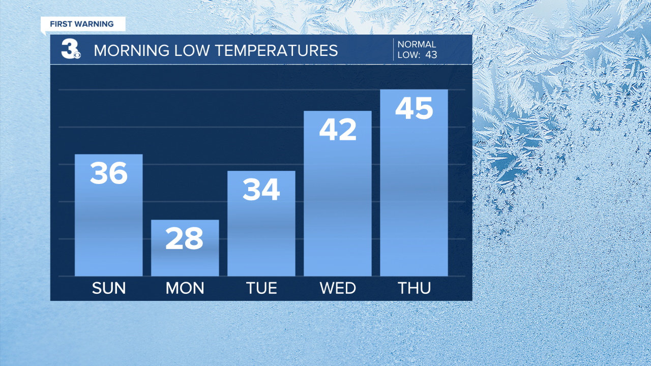
Temperatures will trend upward starting Tuesday. Highs will top out in the mid 50s with building clouds. A spotty shower will be possible on Wednesday with highs in the upper 50s.

More clouds on Thanksgiving with highs in the upper 50s. Keeping a chance for showers late. Better chances heading into Friday with highs in the low 60s. We will continue to monitor the timing of the rain for the holiday.

Meteorologist April Loveland
For weather updates on Facebook: HERE
Follow me on Twitter: HERE
Follow me on Instagram HERE
Check out the Interactive Radar on WTKR.com: Interactive Radar
