


Meteorologist Kristy Steward's First Warning Forecast
Happy Saturday night! It was a sunny, cooler day. Some locations didn't even make it out of the 50s. If you prefer warmer weather, we've got that on the way!
A disturbance passing through tonight will bring passing clouds and a few rain showers. Isolated showers across Hampton Roads. Scattered activity and a few embedded heavy downpours across Dare county and the Outer Banks. Main timing on showers will be 2-8 AM Sunday. Winds will also pick up to 10-15 MPH later tonight with this disturbance. We'll reach our coolest point in the night soon after Midnight, then we gradually start warming up. Mid-40s overnight warm to the upper 40s by Sunday morning.

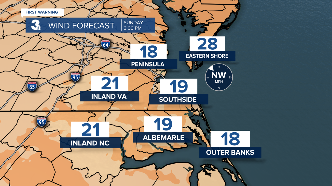
Clouds quickly clear out Sunday morning. Majority of Sunday will be dry and windy. 10-20 MPH westerly winds. High temperatures reach the upper 60s.
Monday stays dry, but it will be cooler. Highs only reach the low 60s. Clouds increase late in the day ahead of our next approaching system. This system will stall out across the Mid-Atlantic and bring us an unsettled pattern for the rest of the week. Temperatures mid-week soar into the mid 70s Tuesday - Thursday. Winds also become gusty and we'll have periods of scattered rain showers. The widespread rain event looks to be Tuesday evening into Wednesday morning. More isolated to widely scattered rain is possible throughout the entire day Thursday.

Stray showers may pop-up Friday and Saturday. We'll have a little more sunshine outside both days, but also cooler temperatures. Highs Friday in the mid to upper 60s become highs in the low 60s Saturday.
Connect with Meteorologist Kristy Steward:
