


Meteorologist Kristy Steward's First Warning Forecast
Happy Saturday night! This afternoon we had a round of strong to severe storms roll through as we continue in this stuck pattern. Eventually a cold front will wipe out this pattern, but it will also bring us more severe weather.
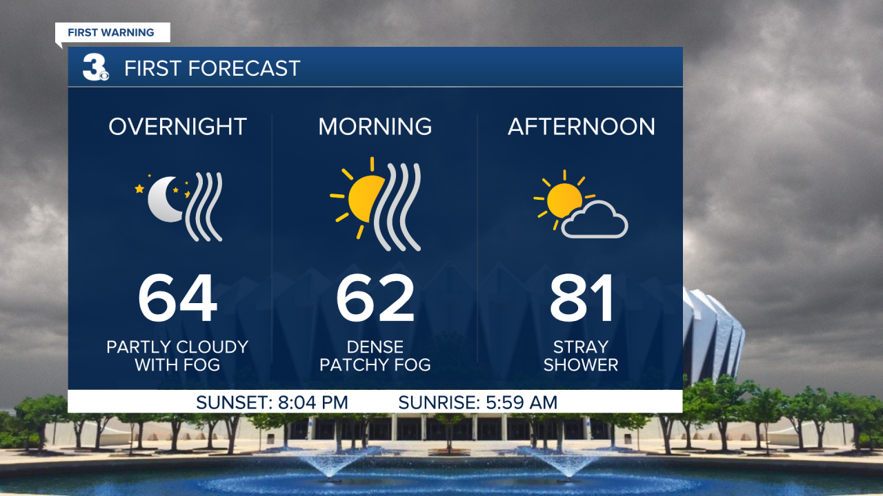
Tonight remains warm in the low 60s. Now that the rain has left us, patchy dense fog is forming again.
A Dense Fog Advisory is in effect until 10 AM Sunday for the Eastern Shore. Expect visibility less than 1/4 mile in some places. Take it slow and use your low beams in these dense patches.

Sunday is shaping up to be a nicer day. Patchy fog in the morning, but mostly dry and partly cloudy throughout most of the day. After 8 PM, we could have a round of scattered storms travel mainly through the Peninsulas and Eastern Shore. Sunday will be warmer in the low 80s.
We’ll have to look between clouds at times, but look up Sunday night! We will be having a total lunar eclipse. It’s actually dubbed the Super Flower Blood Moon Lunar Eclipse because it will be a full moon and supermoon (when the moon is closest to the Earth, appearing bigger and brighter in the night sky). The Flower part comes from this being the time of year when many flowers are in bloom. It will also turn reddish in color because of the eclipse, hence Blood Moon. The partial eclipse begins at 10:28 PM Sunday, peaks at 12:11 AM Monday, and ends at 1:55 AM Monday. Our next total lunar eclipse won’t be until November 5, 2022, so enjoy this one!
Even after the eclipse, we’ll need to keep an eye to the sky. Severe storms could impact us Monday afternoon and evening. A strong cold front will bring us a line of storms moving from the northwest to the southeast. Right now, it looks like this line starts passing through around 4 PM Monday, impacts the 7 cities around 7 PM, and exits the Outer Banks by 2 AM Tuesday. A good chunk of the area is already under a Level 2 out of 5 risk for severe weather.

The main threats are damaging winds and smaller hail, but a spin-up tornado or two can’t be ruled out.

Ahead of these afternoon and evening storms, Monday will be partly cloudy and warm with highs reaching the mid 80s.
After the front passes through, storms finally come to an end and the clouds will also quickly clear out. Expect lots of sunshine Tuesday and temperatures to only be a few degrees cooler around 80°.
Wednesday will be even cooler, down to the mid 70s. Wednesday stays mostly dry, but clouds increase ahead of a warm front heading this way Thursday morning. This warm front will bring us widely scattered storms throughout Thursday along with a bump in temperatures. Highs Thursday in the low to mid 80s jump into the upper 80s Friday and Saturday.
Next weekend is looking like great beach weather! Mostly dry, plenty of sunshine and temps possibly touching 90° in a few spots.
Connect with Meteorologist Kristy Steward:
