


Meteorologist April Loveland's First Warning Forecast
The warming trend continues on Wednesday. It will still be dry with highs in the lower 70s. Skies will be partly to mostly sunny.
Even warmer on Thursday. Highs will soar to the mid 70s. It'll be another gorgeous day with blue skies and sunshine. Be sure to get outside and enjoy the weather!

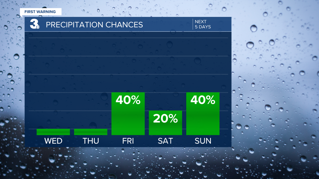
Scattered showers will be possible by late Friday. It will be the warmest day of the week with highs near 77 degrees. A few areas may even touch the 80 degree mark!
Saturday will be cooler behind a cold front. Highs will warm to the mid 60s with a mix of sun and clouds.
Scattered showers will be possible for St. Patrick's Day. As of now, it's not looking like a complete washout. Temperatures will warm to the upper 60s.
Drier and cooler heading into Monday. Highs will warm to the upper 50s.
The First Day of Spring is looking to be a chilly one! Highs will only rise into the upper 40s, which is well-below normal for this time of year. Conditions should stay dry with partly cloudy skies.

Pollen Forecast:

Meteorologist April Loveland
For weather updates on Facebook: HERE
Follow me on Twitter: HERE
Follow me on Instagram HERE
Check out the Interactive Radar on WTKR.com: Interactive Radar
