


Meteorologist Kristy Steward's First Warning Forecast
Happy Wednesday night! It’s was a hot and steamy day. Expect much of the same heat and humidity Thursday before a cold front comes to our rescue Thursday night.
Mostly clear and muggy tonight. Lows in the low to mid 70s. Temperatures will climb into the low to mid 90s again Thursday. Ahead of the cold front, we’ll have a line of strong to severe storms Thursday afternoon and evening, likely starting to move into Hampton Roads around 6 PM.

Our Virginia communities are under a level 2 of 5 risk for severe storms. Our North Carolina communities are under a level 1 of 5 risk. Main concern is damaging wind gusts, however, a brief spin-up tornado can’t be completely out of the question under a level 2 risk. Stay weather aware Thursday PM.
Behind the cold front, temperatures will become more seasonable with highs around 80° Friday through Sunday. A pretty pleasant weekend is on tap. A few spotty showers Friday. Drier, less humid, and a bit breezier with a mix of sun and clouds this weekend.
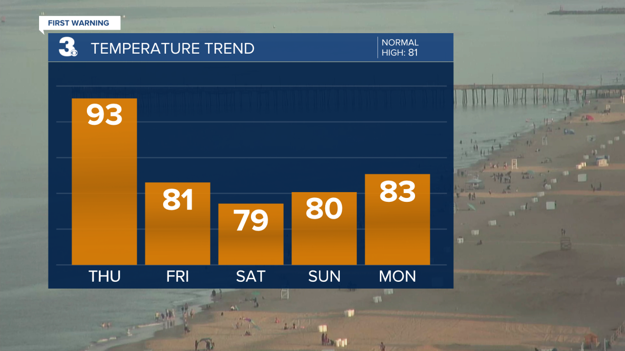
We stay partly cloudy and mostly dry through at least the first half of the workweek. Temperatures will gradually be on the rise again. Climbing into the lower 80s Monday, jumping into the upper 80s Tuesday and Wednesday.
Tropical Update:
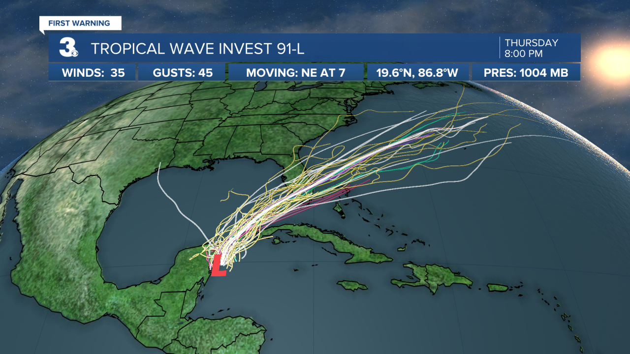
A broad area of low pressure located near the east coast of the Yucatan Peninsula is producing a large area of disorganized showers and storms over the northwestern Caribbean Sea and Yucatan Peninsula. This system is expected to gradually develop into a tropical depression while it moves northeast. It will eventually head toward Florida.
*Formation chance next 48 hours: High (80%)
*Formation chance next 5 days: High (80%)
Connect with Meteorologist Kristy Steward:
