


Meteorologist Kristy Steward's First Warning Forecast
Happy Friday! It’s been a gloomy start to our long holiday weekend, but most of the weekend is looking much better.
Our severe threat is now over. We could still see another line of scattered showers or storms later this evening, but this first round weakened the energy available in the atmosphere enough that we shouldn’t see any of those upcoming storms become severe.
We dry out later tonight, but the clouds stick around. Overnight lows in the upper 60s.
Our long holiday weekend is looking very nice! Highs in low to mid 80s, mostly dry and partly cloudy both Saturday and Sunday. A stray shower or storm in the afternoon and evening can’t be completely ruled out, but most areas should stay dry.
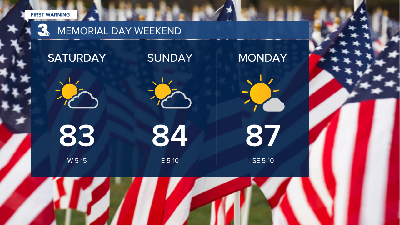
Memorial Day itself is going to be a bit sunnier, drier, and warmer. Highs in the upper 80s. Perfect for any outdoor cookouts and other celebrations you have planned!
Most of the workweek will stay dry with plenty of sunshine, but temperatures continue to climb. A steamy midweek with highs in the low 90s. A cold front Friday will bring us a little cool down to the mid 80s. It will also bring us isolated to scattered showers and storms on Friday.
Connect with Meteorologist Kristy Steward:
