


Meteorologist Kristy Steward's First Warning Forecast
Happy Thursday evening! Many of us have been waiting for a warmup and we’ll finally get it tomorrow! However, the system bringing us this warmth will also bring us very strong winds and a severe storm threat.
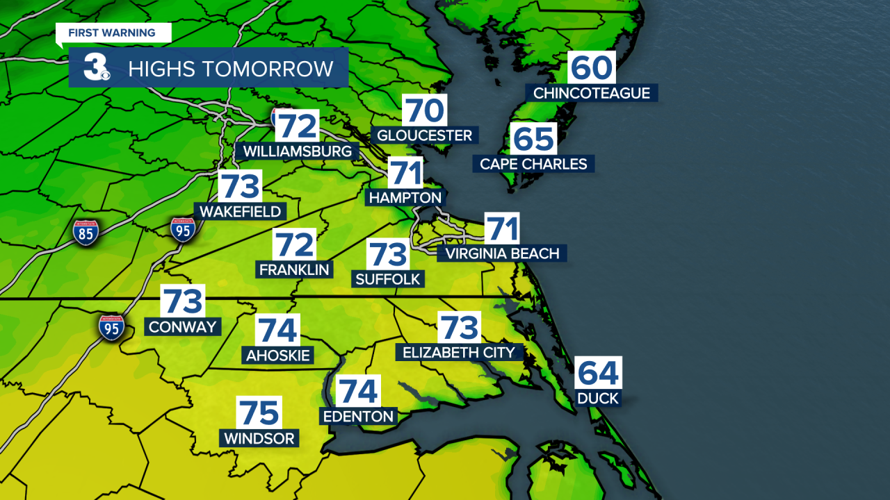
Temperatures tonight drop into the lower 40s. Late tonight and early Friday morning, clouds will start to increase. Expect increasing clouds throughout Friday. Breezy south winds of 10-20 MPH gusting to 30 MPH will help high temperatures reach the low 70s.
Later in the day, after 4 PM, is when scattered rain showers start moving in. This first round of showers will continue throughout Friday evening, then there will be a drier break overnight into Saturday morning.
Saturday gets super windy. Sustained southwesterly winds of 25-35 MPH gusting upwards of 50 MPH. Be sure to secure any loose outdoor items you don’t want blown away before Saturday. These very strong winds will also help temperatures soar into the upper 70s.

The powerful cold front from this system moves through Saturday afternoon. Ahead of it, expect a wide line of scattered showers and thunderstorms. Some of these storms could become strong to severe. Right now, the Albemarle Sound and Outer Banks are under a Level 1 of 5 risk for severe storms.

Damaging wind gusts are the primary threat, but a brief, isolated spin-up tornado can’t be ruled out. That risk could get extended farther north over the next couple days, so stay tuned for updates. The main line of storms starts around Noon and continues through the afternoon.
Behind this powerful cold front, temperatures plunge. Highs on Sunday in the upper 50s. At least there will be lots of sunshine. However, it will still be breezy.
It’s only a one-day cool down. High temperatures return to the 70s for the workweek. Highs right at 70° Monday continue to climb into the upper 70s Wednesday. The first half of the week will be dry with sun and clouds. Another system Wednesday into Thursday will likely pick up our winds again and bring more scattered showers.
Connect with Meteorologist Kristy Steward:
FACEBOOK
TWITTER
INSTAGRAM
