


Meteorologist April Loveland's First Warning Forecast
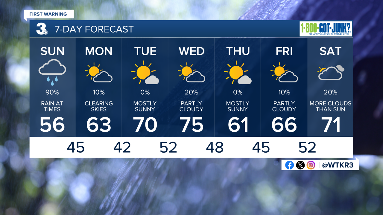
Widespread rain today as an area of low pressure moves across the area. Rain will move in from the southwest to northeast today. It will be a chilly and damp day with highs only warming to the mid 50s. Cool Sunday night with clearing skies and lows in the low and mid 40s.
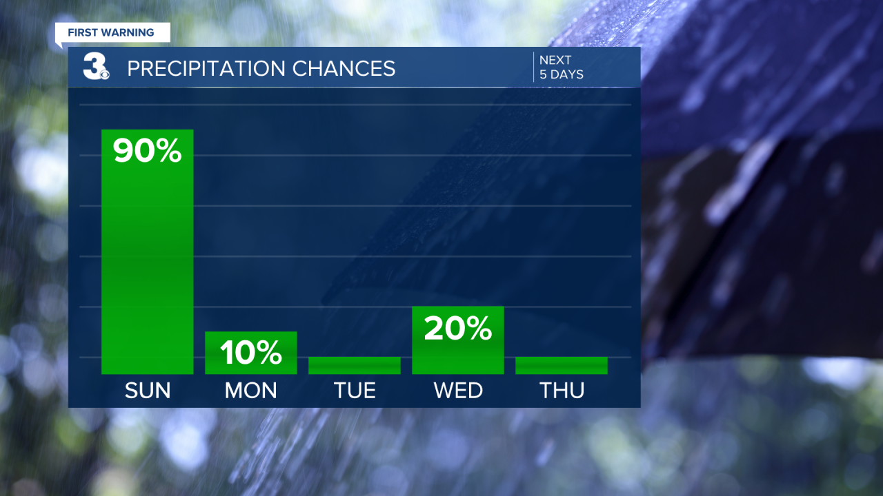
Skies will turn partly cloudy on Monday with highs in the low 60s.
High pressure will be in control on Tuesday. Skies will be mostly sunny with highs warming to near 70.

We'll finally climb to the mid 70s on Wednesday under partly cloudy skies. A cold front will move through, but it's looking mainly dry right now. It will however, drop our temperatures for Thursday.
Thursday will fall back into the low 60s under mostly sunny skies.
Partly cloudy and dry to end the work week with highs in the mid and upper 60s.
Meteorologist April Loveland
For weather updates on Facebook: HERE
Follow me on Twitter: HERE
Follow me on Instagram HERE
Check out the Interactive Radar on WTKR.com: Interactive Radar
