


Meteorologist Kristy Steward's First Warning Forecast
Happy Friday night! Buckle up! We are about to see all 4 seasons in just one day.
We are currently between two frontal boundaries. One to our south and another to our north. The one to our south will lift north as a warm front, colliding with the cold front arriving from the northwest. On top of the merging fronts, a low pressure system will strengthen over Hampton Roads.
This evening into tonight we’ll have a round of scattered rain showers and possibly a few rumbles of thunder mixed in. We are under a Level 1 threat for severe weather tonight, but we aren’t really concerned with the storm potential tonight. The concern comes in Saturday morning.
You need to be weather aware 7 AM - 10 AM Saturday. Most of the viewing area is under a Level 3 of 5 severe risk. Some thunderstorms could and likely will become severe. The main concerns are damaging winds, isolated tornadoes, and heavy downpours creating localized flooding. Around 1-1.5” rain expected.

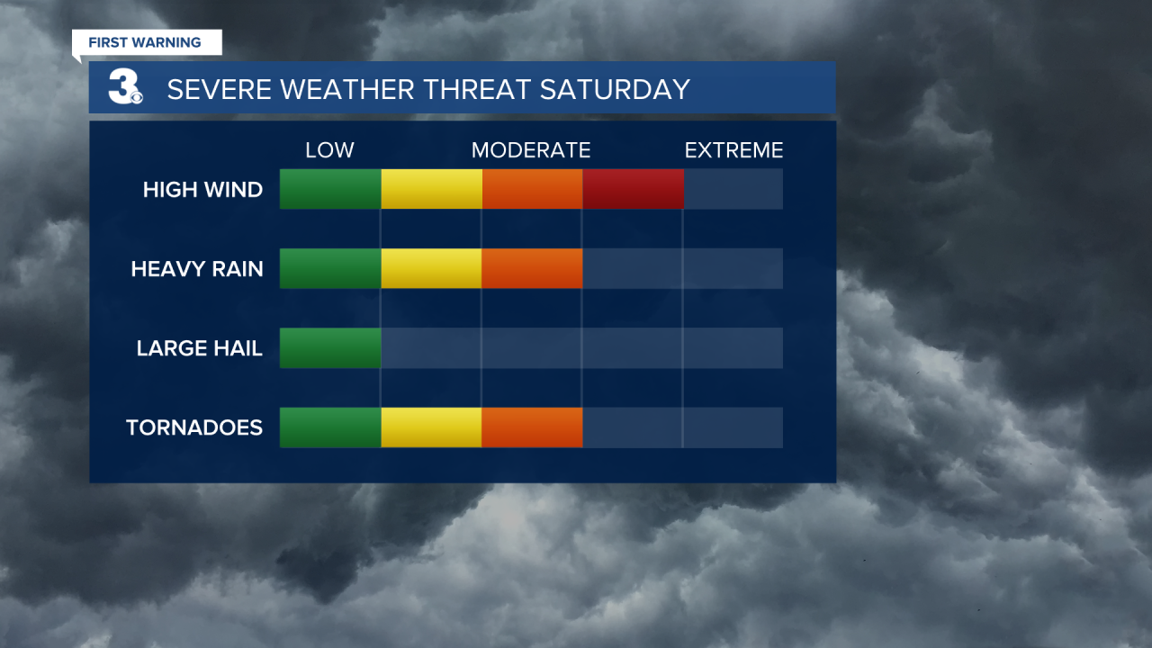
We are under a Wind Advisory from 10 AM - 7 PM Saturday. Winds could gust as high as 60 MPH, especially along the Eastern Shore. Sustained winds around 20-35 MPH. Make sure you secure any loose outdoor items and prepare for power outages and downed tree limbs.

Those strong winds will bring 7-10’ waves in the Atlantic and 3-5’ waves in the Chesapeake Bay. Overwash in the Outer Banks is likely.
With the warm front tonight, temperatures will gradually be on the rise to the mid 60s early Saturday morning. Then temperatures plummet into the 30s early Saturday afternoon. As temperatures plunge, rain transitions into snow around Noon. With strong winds and a warm, wet ground, it will be really hard for snow to stick. At most, a light dusting on grassy and elevated surfaces.
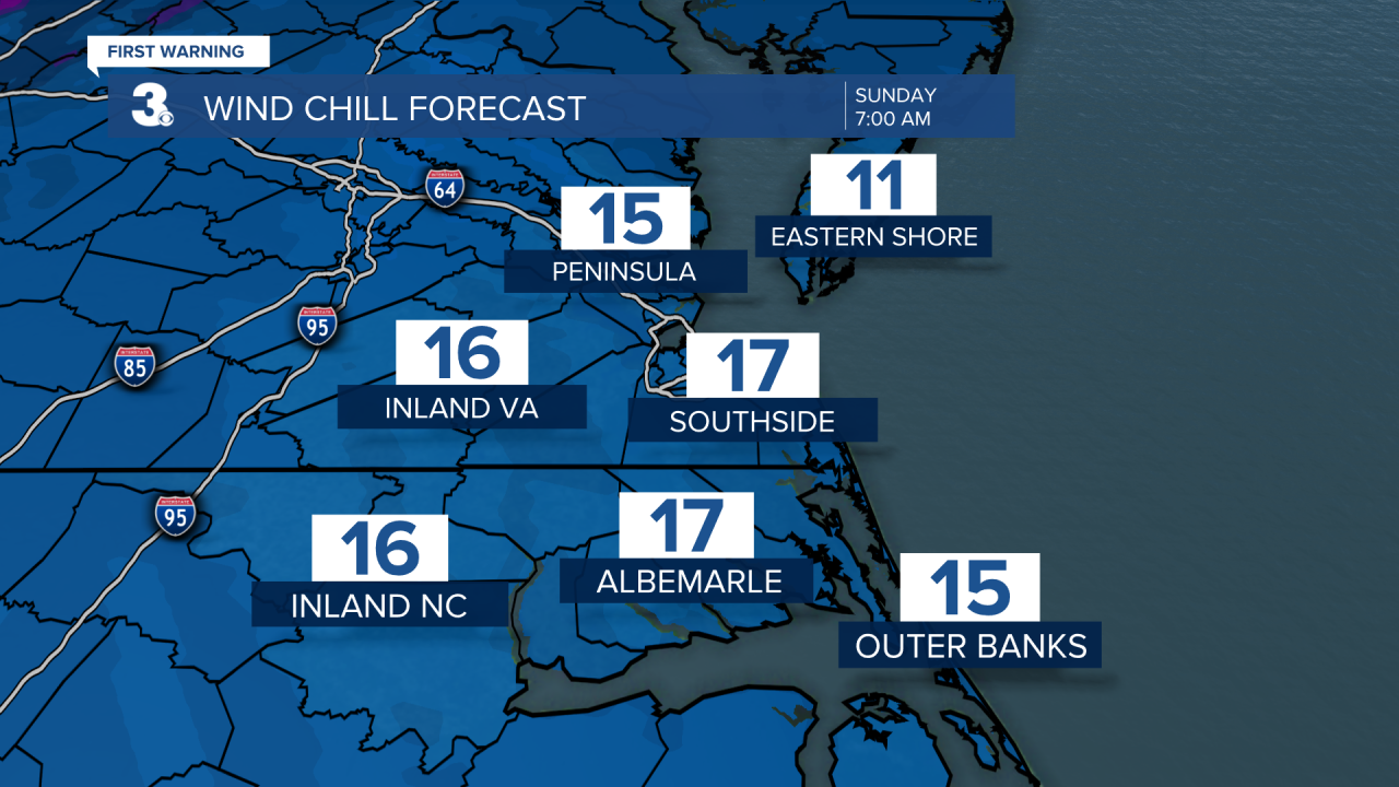
We dry out and clouds clear out Saturday evening. Temperatures tumble down to the mid 20s, feeling like the mid-teens, late Saturday night into early Sunday morning. Make sure you bring any sensitive plants indoors or cover them up Saturday night! Also, don’t forget to set your clocks forward one hour as Daylight Saving Time begins at 2 AM Sunday.
Sunday stays dry and chilly with tons of sun. Highs in the upper 40s.
Next week will be nicer to us. Highs in the low 60s with a brief jump to 70° both Tuesday and Friday. Mostly dry with a mix of sun and clouds for most of the week. A coastal low pressure system brings us scattered rain showers Thursday.
Connect with Meteorologist Kristy Steward:
