


Meteorologist Kristy Steward's First Warning Forecast
Happy Wednesday evening! Today was much cooler following the powerful cold front yesterday. We had around a 20° temperature drop! A second cold front will cool us down even more tonight. If you like the warmth, don’t worry, we’ll be back to the 80s in just a handful of days.
This secondary dry reinforcing cold front will pass through overnight. Mostly clear and dry, but much cooler. Expect overnight lows to drop into the upper 30s and low 40s. Around the front, winds will pick up to gusts around 30 MPH tonight through Thursday.
Thursday will be a bit cooler. Highs in the lower 60s. While it’ll be cool and breezy, it’ll be sunny!
Temperatures warm a few degrees into the mid 60s Friday and Saturday. We’ll stay dry with plenty of sunshine as we head into the weekend.
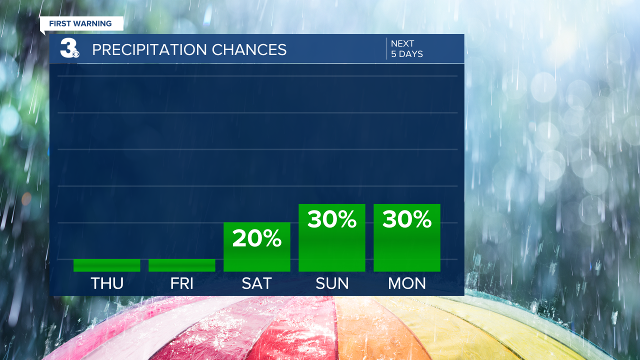
Late Saturday we move into an unsettled weather pattern and will stay in this unsettled pattern through the first half of next week. Sunday through Wednesday will feature off and on isolated to scattered rain showers. On the flip side, temperatures will be on the rise. Highs Sunday in the low 70s bump to the mid 70s Monday and around 80° for the middle of next week.

Connect with Meteorologist Kristy Steward:
