


Meteorologist April Loveland's First Warning Forecast
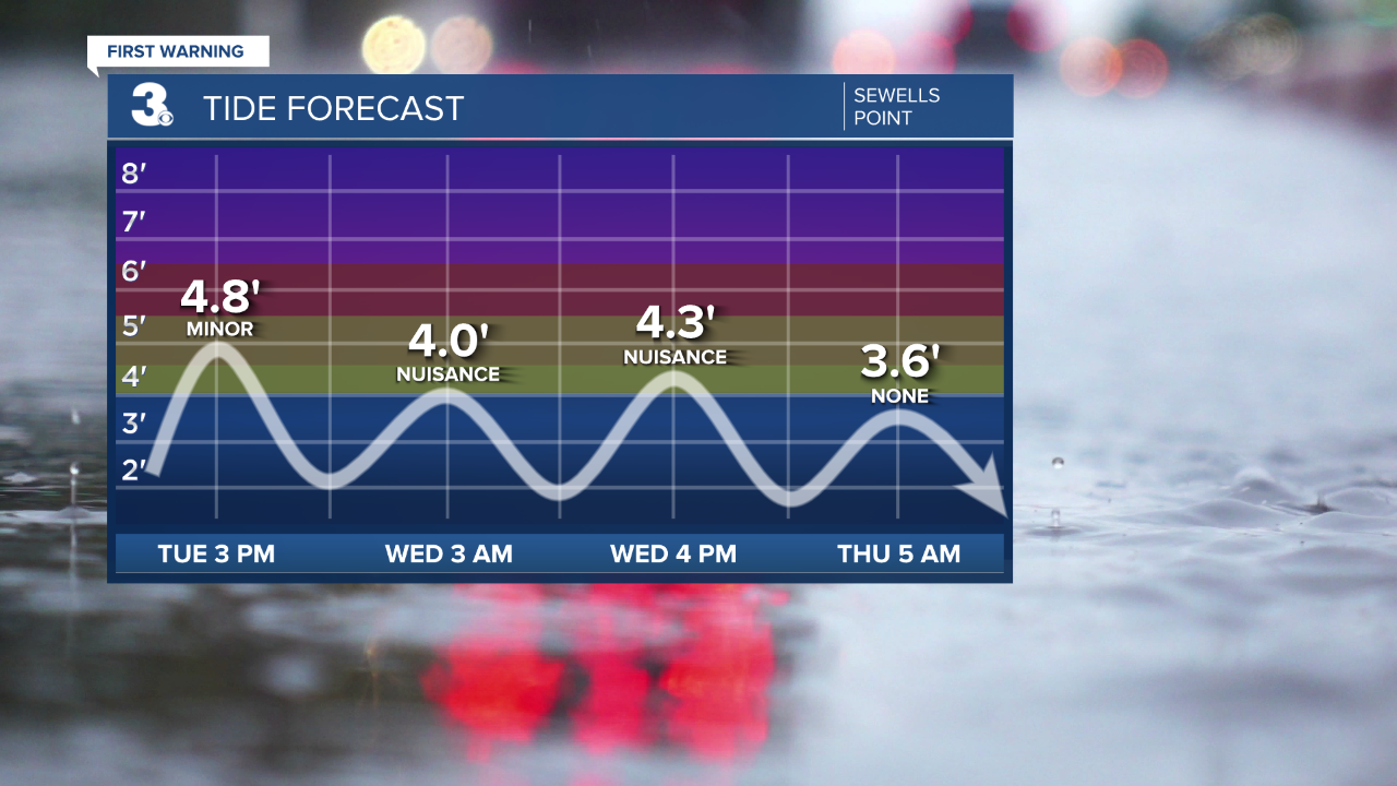
**Coastal Flood Advisory in effect until 10 PM
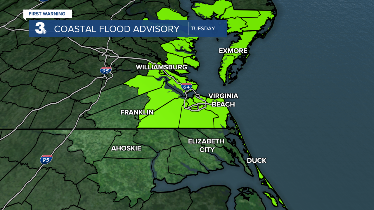
Another messy day… An area of low pressure continues to churn off the NC/VA coast. Clouds, showers, wind, and flooding remain over the area. Expect mostly cloudy skies again today with scattered showers and drizzle. It
will be breezy today with north winds at 10 to 15 mph with higher gusts. Expect minor level flooding during times of high this afternoon. Highs will struggle to reach the mid 70s again today.
Expect more sunshine and a warmup to end the work week. Highs will climb to the upper 70s on Wednesday, low 80s on Thursday, and mid 80s on Friday. We will see mostly sunny to partly cloudy skies with low rain chances and light winds.
We are tracking a cold front for this weekend. Scattered showers/storms are possible later Saturday, but this does not look like a big rainmaker for us. It will bring a dramatic change in temperature. We will fall from the mid 80s on Saturday to the low 70s on Sunday.
Meteorologist April Loveland
For weather updates on Facebook: HERE
Follow me on Twitter: HERE
Follow me on Instagram HERE
Check out the Interactive Radar on WTKR.com: Interactive Radar
