


Meteorologist Kristy Steward's First Warning Forecast
Happy Saturday night! What a difference a day makes! We had a gorgeous start to our holiday weekend with temperatures 15-20° cooler than they were yesterday. Beautiful weather continues through this holiday weekend, then the heat will return in time for Summer to officially begin.
Clear and cool tonight. Lows in the mid 50s inland and low 60s along the coast. Staying breezy with north-northwest winds of 10-20 MPH gusting up to 30 MPH.
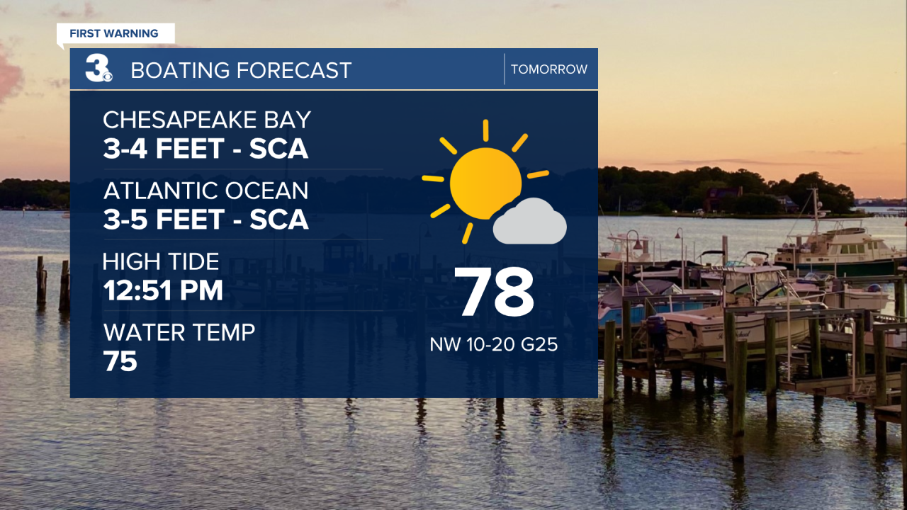
Sunday will be a little cooler than today with highs in the upper 70s, no humidity, and a breeze. Northwest winds 10-20 MPH gusting up to 25 MPH. Perfect for any Father’s Day or Juneteenth celebrations going on!

Be a little more cautious if you’re heading out on the water. A Small Craft Advisory and moderate rip current risk are in effect Sunday. 3-4’ waves in the Chesapeake Bay and 3-5’ waves in the Atlantic.
Gorgeous weather with plenty of sunshine and highs around 80° continues Monday. Some morning clouds are possible, but they’ll clear out for the afternoon and evening.
Tuesday is the official start to summer and summertime heat returns to Hampton Roads right on cue! Highs will be in the upper 80s to low 90s starting Tuesday and continuing into the weekend. We’ll also see a partly cloudy sky. We should stay mostly dry until Friday when isolated storm chances creep into the forecast.
Connect with Meteorologist Kristy Steward:
FACEBOOK
TWITTER
INSTAGRAM
