


Meteorologist Kristy Steward's First Warning Forecast
Good Sunday night! It was another hot day with high temperatures in the upper 80s to low 90s, a few degrees cooler than yesterday. A cold front is heading our way tonight that will bring us big relief from this heat, but also a soggy stretch next week.
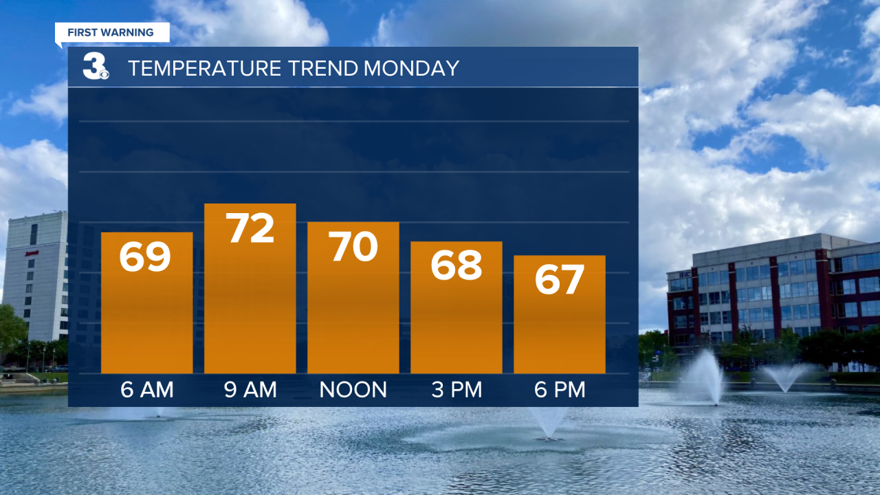
The cold front passes through Monday morning. So, our overnight lows will be in the upper 60s, we’ll warm up just a few degrees into the low 70s mid-morning, then the cold front passes and brings us dropping temperatures the rest of the day. By the evening, expect temperatures to be in the mid 60s.
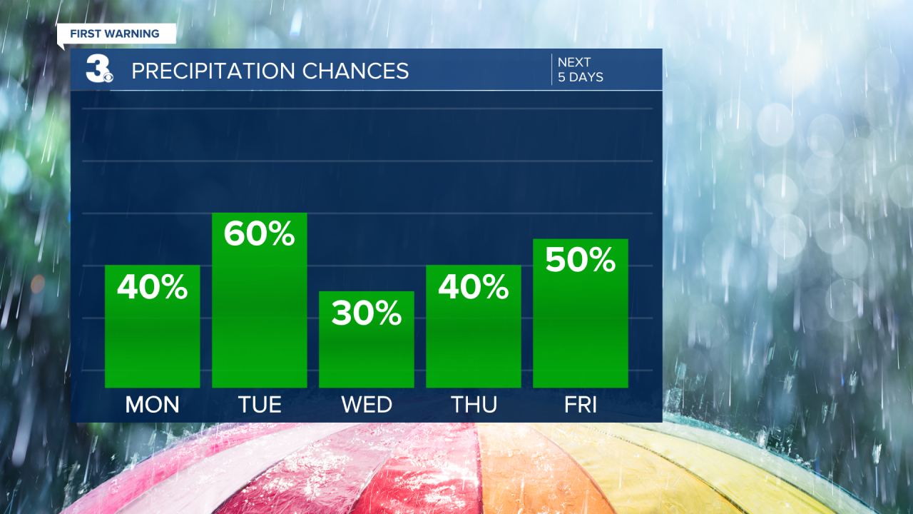
Behind the front Monday evening, we’ll also see more scattered showers and storms. Then the front stalls to our south Tuesday and lifts back over Hampton Roads as a warm front Wednesday evening. That keeps us in this soggy pattern with scattered showers Tuesday and isolated storms Wednesday. Tuesday will be the coolest day this week with highs in the mid to upper 60s. The warm front warms temperatures into the mid 70s Wednesday and low to mid 80s Thursday. Expect more scattered storms Thursday.
On Friday, a weaker cold front passes through in the morning/midday hours. That will bring more scattered storms Friday, but it will only drop temperatures a couple degrees near 80. We stay around 80° all of next weekend.
Next weekend is looking decently dry right now with a mix of sun and clouds both days. A slightly higher chance for spotty showers Sunday.
While we do have rain/storm chances each day this week, not one day looks like a total washout. Just keep the rain gear close by as we’ll have several rounds of off/on scattered showers and storms throughout the week.
Connect with Meteorologist Kristy Steward:
