


Meteorologist April Loveland's First Warning Forecast
We've got quite the temperature spread through next week. Conditions though, look to remain mostly dry, minus a few spotty showers.
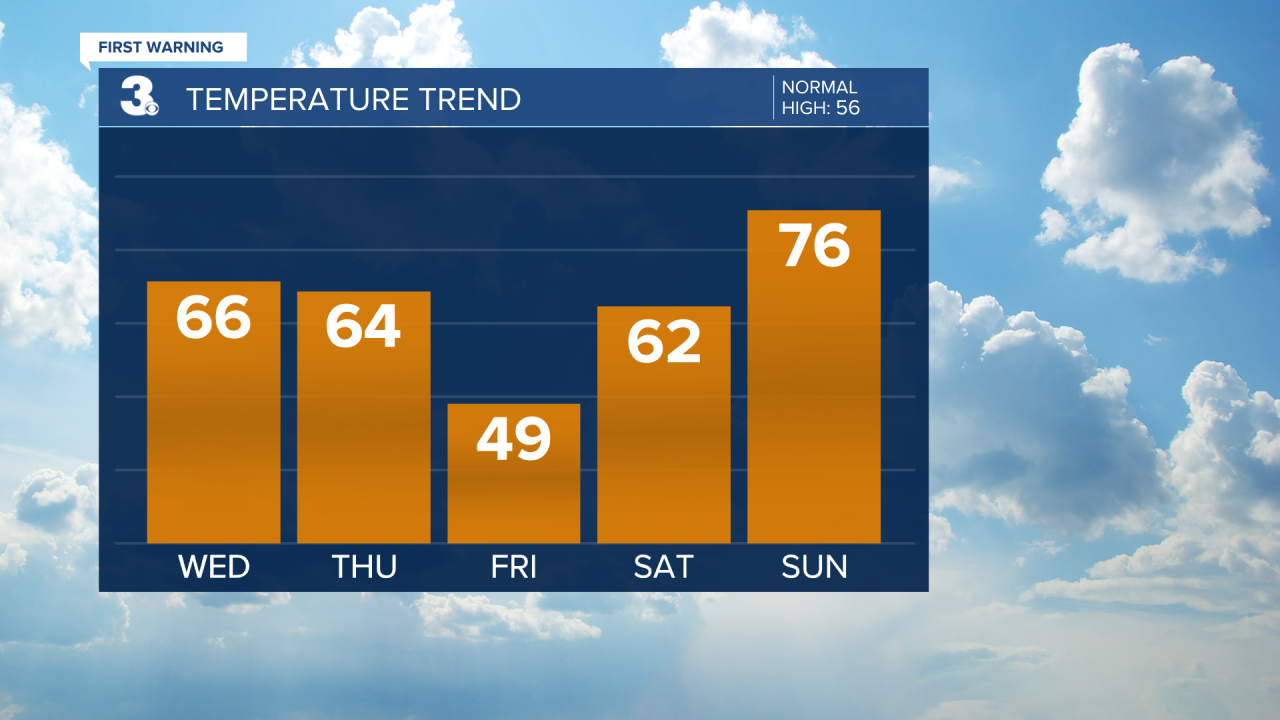
The picks of the week will be today and Thursday as highs soar to the mid and upper 60s today and the low to mid 60s on Thursday. Skies will be mostly sunny today. A few more clouds will build in on Thursday.
Temperatures will take a plunge to end the work week, but it will still feature a nice mix of sun and clouds. Highs will plummet into the upper 40s.
Back to the 60s by Saturday and 70s by Sunday. Keeping a slight chance for a spotty shower both days.
If you are waiting for summer-like temperatures, we may even get close to the 80 degree mark on Monday.
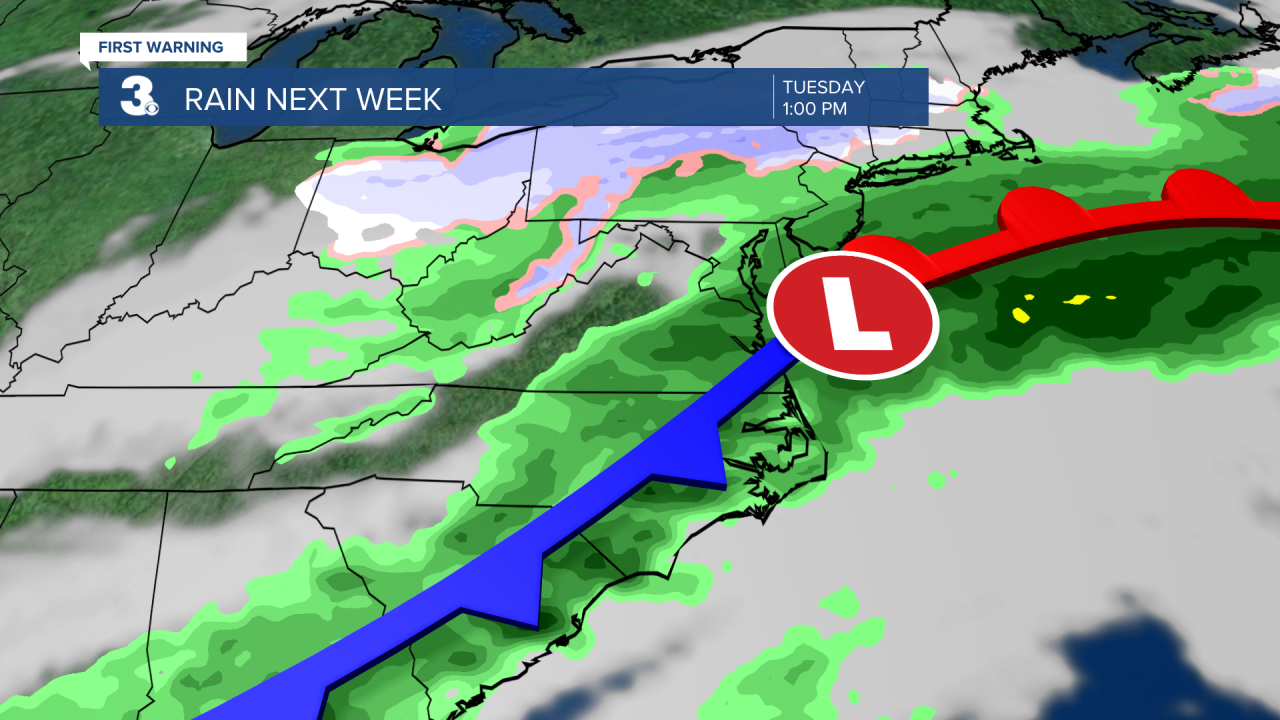
Scattered showers will move in on Tuesday along with a temperature drop. Expect highs in the low 60s.
Meteorologist April Loveland
For weather updates on Facebook: HERE
Follow me on Twitter: HERE
Follow me on Instagram HERE
Check out the Interactive Radar on WTKR.com: Interactive Radar
