


Meteorologist April Loveland's First Warning Forecast
Spring-like weather makes a quick return, and then back to below-normal temperatures. Unsettled weather settles in today through the remainder of the week.
Several disturbances will move through the area through the end of the work week. Showers will be around today and move out by early afternoon. Temperatures will warm to the low 70s, but will fall into the 40s overnight behind the cold front.
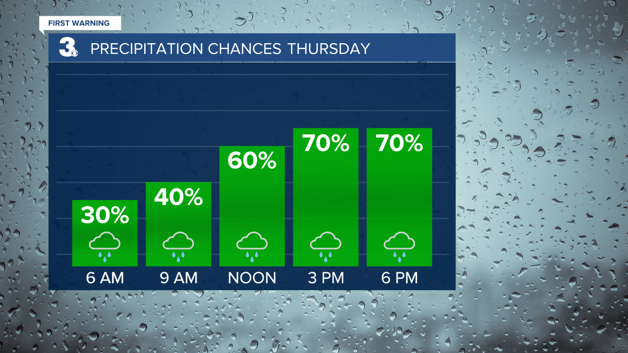
We will feel the result of the cold front on Thursday as highs will only warm to the upper 40s. You'll need the umbrellas once again.
If you're not a fan of the cold and wet weather, Friday will feature warm and wet weather. Expect highs in the low 70s with showers possible. It won't be a complete washout and most of the wet weather will be confined to the morning hours. Temperatures will take another plunge on Saturday, but it will be dry with highs in the low and mid 40s.
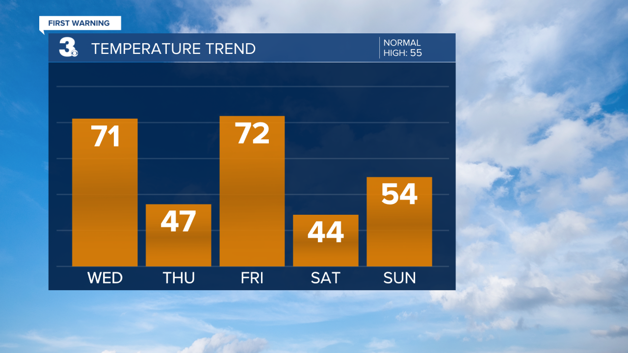
Scattered showers will return on Sunday. Highs will warm to closer to normal in the low and and mid 50s.
Chilly again to kick off the work week. Skies will be partly cloudy with highs in the low 40s. More sunshine will break out on Tuesday with highs in the low 50s.
Meteorologist April Loveland
For weather updates on Facebook: HERE
Follow me on Twitter: HERE
Follow me on Instagram HERE
Check out the Interactive Radar on WTKR.com: Interactive Radar
