


Meteorologist April Loveland's First Warning Forecast

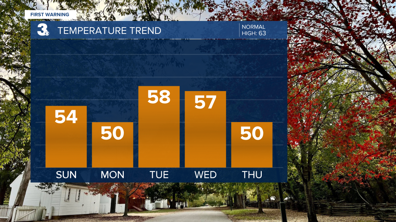
Clouds will break up, but temperatures won't warm a whole lot today. It will be much cooler than Saturday, with highs in the low and mid 50s. It will also be on the breezy side with winds out of the northwest at 10-15 mph, with higher gusts.
Skies will be mostly clear tonight which will allow temperatures to fall into the 30s! We haven't been this cold for a long time.
Monday will have more sun than clouds with highs right around the 50 degree mark.
Rain chances will increase on Tuesday as an area of low pressure approaches. Temperatures will trend a little milder with highs in the upper 50s.

Showers will continue early on Wednesday. Temperatures will warm to the mid and upper 50s.
Drying out and cooling down on Thursday and Friday. Skies will be partly cloudy both days with highs in the upper 40s to near 50.
Meteorologist April Loveland
For weather updates on Facebook: HERE
Follow me on Twitter: HERE
Follow me on Instagram HERE
Check out the Interactive Radar on WTKR.com: Interactive Radar
