


Meteorologist April Loveland's First Warning Forecast
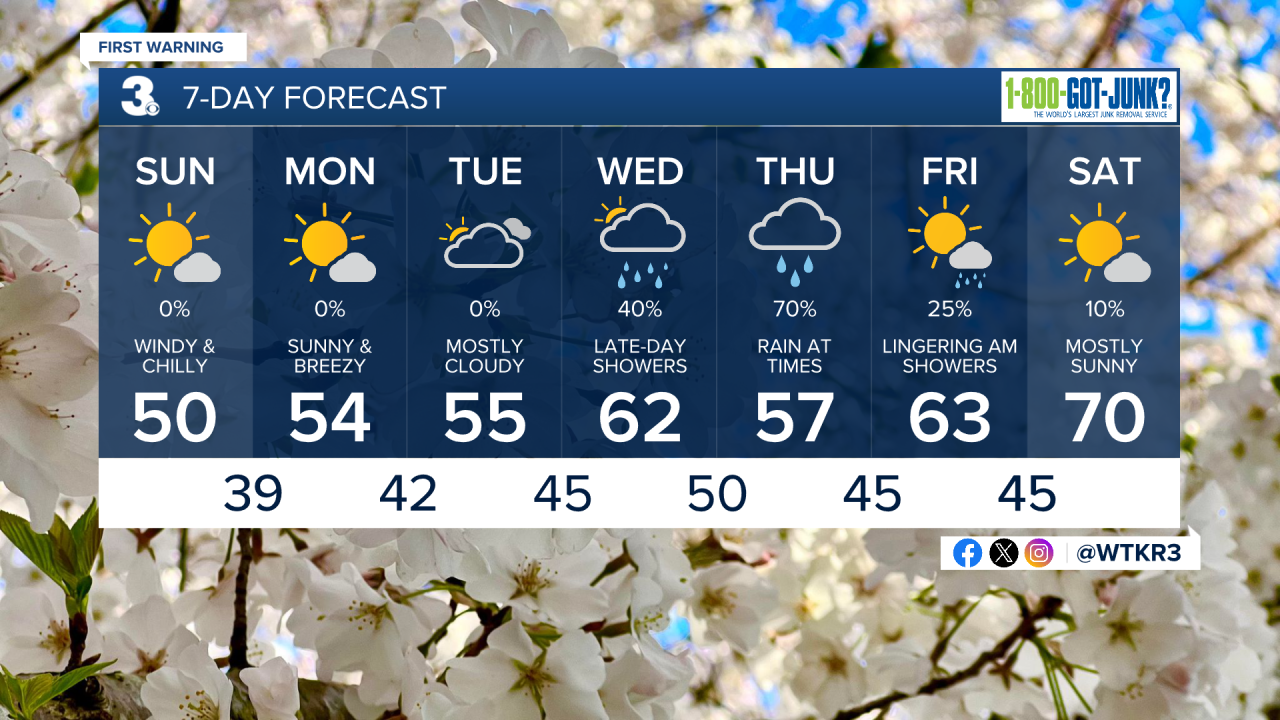
Temperatures will only warm to the upper 40s and low 50s, which is about 10-15 degrees below normal for this time of year. Expect winds out of the north at 20-30 mph, with gusts up to 45 mph possible.


Even though it won't be raining, flooding will still be an issue. Tidal flooding will be possible starting Sunday and continue through at least Tuesday. As of now, high tide as Sewells Point on Monday at 10 PM, looks to be the worst of it.

The sun and wind will stick around for Monday. Temperatures will once again top out in the low 50s.
Still breezy, but we'll feel some improvement by Tuesday. Winds will be out of the northeast at 10-15 mph, with a few higher gusts. Highs will be in the mid 50s.
Wednesday will warm into the low 60s, but showers will be possible by the afternoon. The wet weather will continue on Thursday. Expect showers and mostly cloudy skies. Temperatures will cool to the mid 50s.

A few lingering morning showers for Good Friday. It will turn breezy with north winds at 15-25 mph, with higher gusts. Temperatures will warm to the low 60s.
Meteorologist April Loveland
For weather updates on Facebook: HERE
Follow me on Twitter: HERE
Follow me on Instagram HERE
Check out the Interactive Radar on WTKR.com: Interactive Radar
