


Meteorologist Kristy Steward's First Warning Forecast
Good Sunday night! It’s been a gorgeous end to our weekend! Highs in the low 80s with low humidity again. We’ll have one more pleasant day before the heat, humidity, and storms start to creep back in.
This evening into earlier tonight, we’ll have passing clouds. They will clear out later tonight. Overnight lows drop into the low 60s. We get breezier tonight with 10-20 MPH northeast winds.
High pressure nudges south over Hampton Roads Monday. That will keep us with lots of sunshine and dry conditions. Still another great day with low humidity and highs around 80°. Likely hitting the low to mid 80s inland and mid to upper 70s along the coast. We stay breezy Monday with 10-20 MPH east-northeast winds. Also expect another day with rougher surf. A high rip current risk Monday with 3-4 feet breaking waves from Tropical Storm Alex in the Atlantic.

Tropical Storm Alex will remain in the Atlantic and only bring us a rougher surf the next couple days.
As high pressure exits and a cold front starts to head our direction, we’ll notice some more clouds Tuesday and warmer temperatures. Highs in the mid 80s. Most should stay dry Tuesday, but stray to isolated showers are possible in the afternoon and evening.
Around the slow-moving cold front, expect scattered storms Wednesday into Thursday. Highs in the mid to upper 80s with higher humidity too.
Behind the front, Friday will be cooler in the lower 80s. Still some spotty showers or storms around, mainly in North Carolina.
This weekend, a low pressure system will develop along the coast and travel right over us. That will bring us a windy Saturday and Sunday. Also expect scattered to widespread rain and storms likely all day Saturday into early Sunday morning.

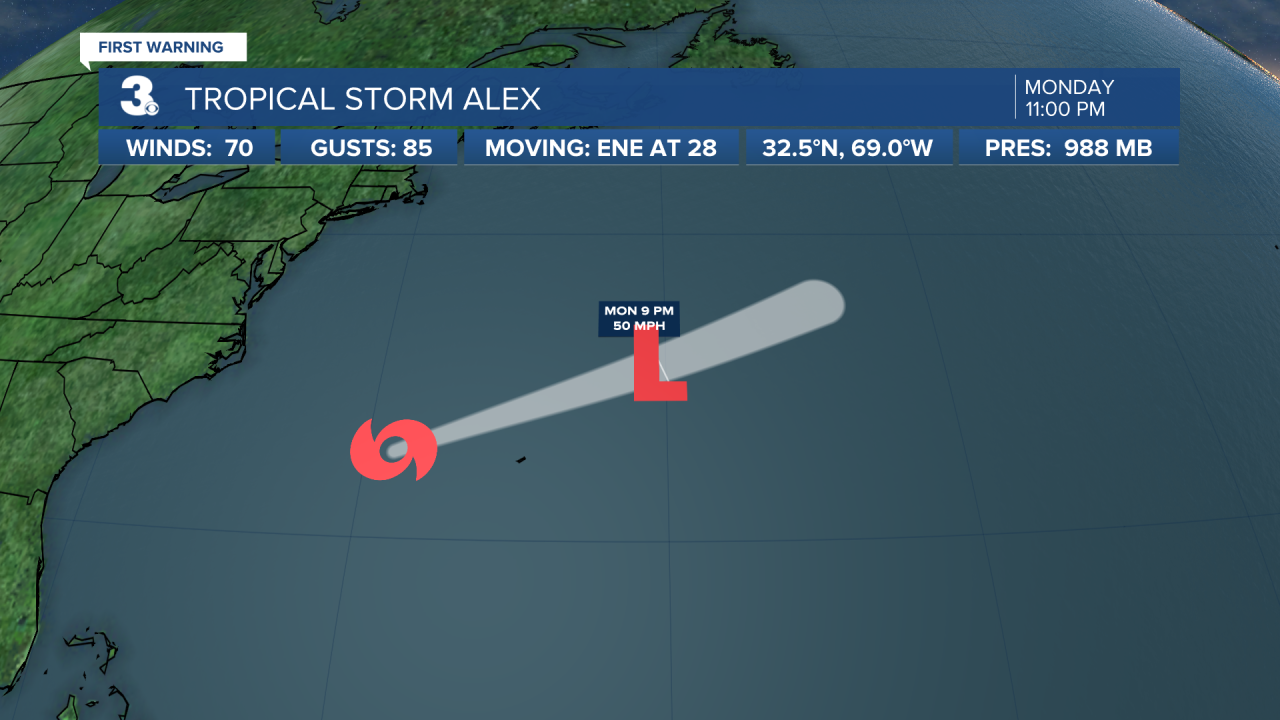
11 PM Sunday Tropical Update:
Tropical Storm Alex is located east of the Carolinas in the Atlantic, about 245 miles west of Bermuda. It’s moving ENE at 28 MPH. It has sustained winds of 70 MPH and a central pressure of 988 mb. Tropical Storm Alex is forecast to weaken into a depression by Monday evening. Locally, it will bring us a rougher surf Monday into Tuesday. High rip current risk Monday with 3-4 feet breaking waves. Moderate rip current risk Tuesday with 3-4 feet waves.
Connect with Meteorologist Kristy Steward:
