


Meteorologist Kristy Steward's First Warning Forecast
Happy Thursday night! We are still in a very active weather pattern that’s going to continue bringing us big temperature swings and a few showers.
Rain clears out tonight and patchy fog develops.

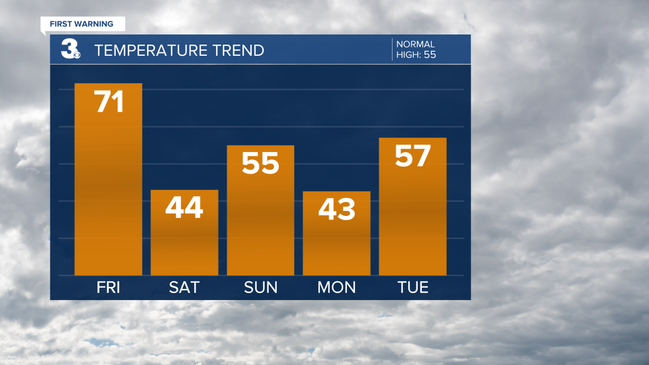
Temperatures are gradually on the rise now through Friday afternoon. When we wake up, temperatures will be in the upper 40s. Eventually they’ll warm into the 70s for most. Low 70s across Southside and Inland Virginia, upper 60s for the Peninsulas, upper 50s along the Eastern Shore, and mid 70s for North Carolina.
A cold front Friday afternoon could bring us a few showers later in the day. It’ll also drop temperatures down to the mid 30s Friday night.
Highs on Saturday return to the mid 40s. Finally on Sunday we should start to see some sunshine again as high pressure starts to nudge it’s way into the Mid-Atlantic. Temperatures get a little warmer in the mid 50s. Then another cold front later Sunday could bring a couple showers and another temperature drop to the lower 40s Monday.
A mix of sun and clouds with mostly dry conditions will be the story most of next week. Temperatures again on the rise into the low to mid 60s by Wednesday before another cold front cools us down Thursday. That cold front will be a little kinder to us and only knock temperatures down into the low 50s. A couple showers are possible next Thursday too.
Connect with Meteorologist Kristy Steward:
