


Meteorologist Kristy Steward's First Warning Forecast
Happy Wednesday evening! Temperatures were a little warmer in the low to mid 80s today. Tomorrow temperatures and humidity will soar and we’ll stay toasty into the Fourth of July holiday. Eventually storm chances increase too.
Tonight we’ll have a mostly clear sky with overnight lows in the mid 60s. Dense patchy fog could form, especially inland late tonight into Thursday morning. Watch for that on your morning commute.
Temperatures soar into the upper 80s Thursday under tons of sunshine. We also stay dry with the exception of a possible rogue shower.
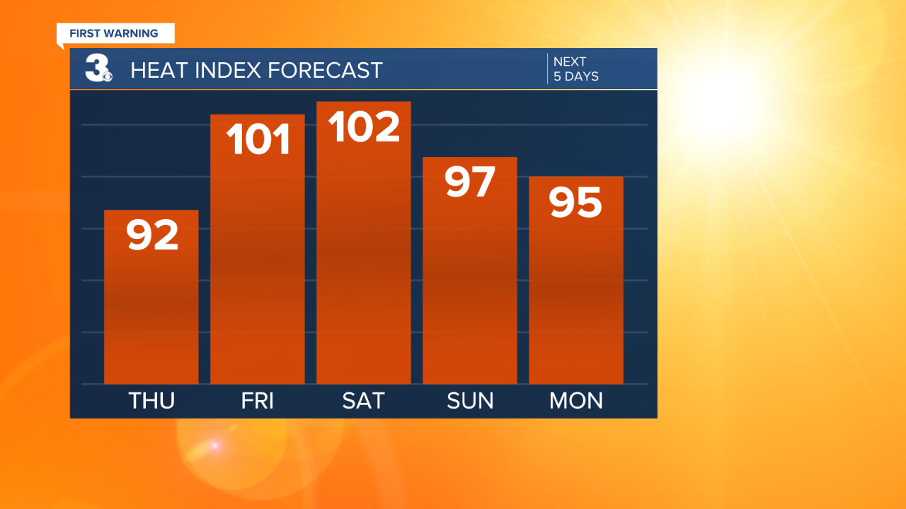
Heat and humidity continue to climb Friday and Saturday. Highs both days in the low 90s, feeling like the low 100s. Friday stays dry, but spotty storms start to pop-up later Saturday.
Scattered thunderstorms activity begins Sunday and continues through at least the first half of the week. Not a washout event any of those days, but definitely some storms to dodge while you’re out celebrating the 4th.
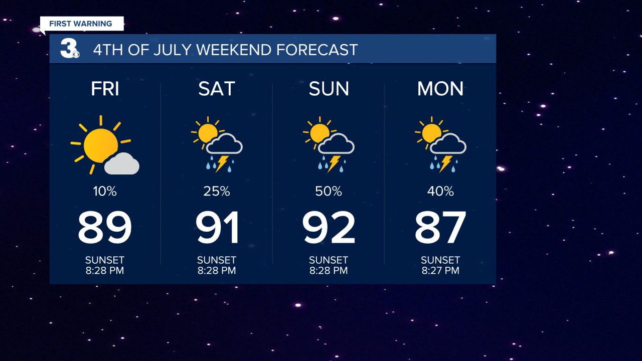
Outside of storms, we’ll still be warm and humid. Highs in the mid to upper 80s, feeling like the mid to upper 90s from Sunday on. Stay cool and dry this holiday weekend!
Tropical Update:
Potential Tropical Cyclone Two is across northern Venezuela. It’s moving quickly west at 24 MPH with 40 MPH sustained winds. It has a 90% chance of formation in both the next 48 hours and next 5 days. This storm will likely become our second named of the season, Bonnie.
There’s another area of disorganized showers and storms in the middle of the tropical Atlantic. It has a 10% chance of formation in the next 48 hours and 20% chance of formation in the next 5 days.

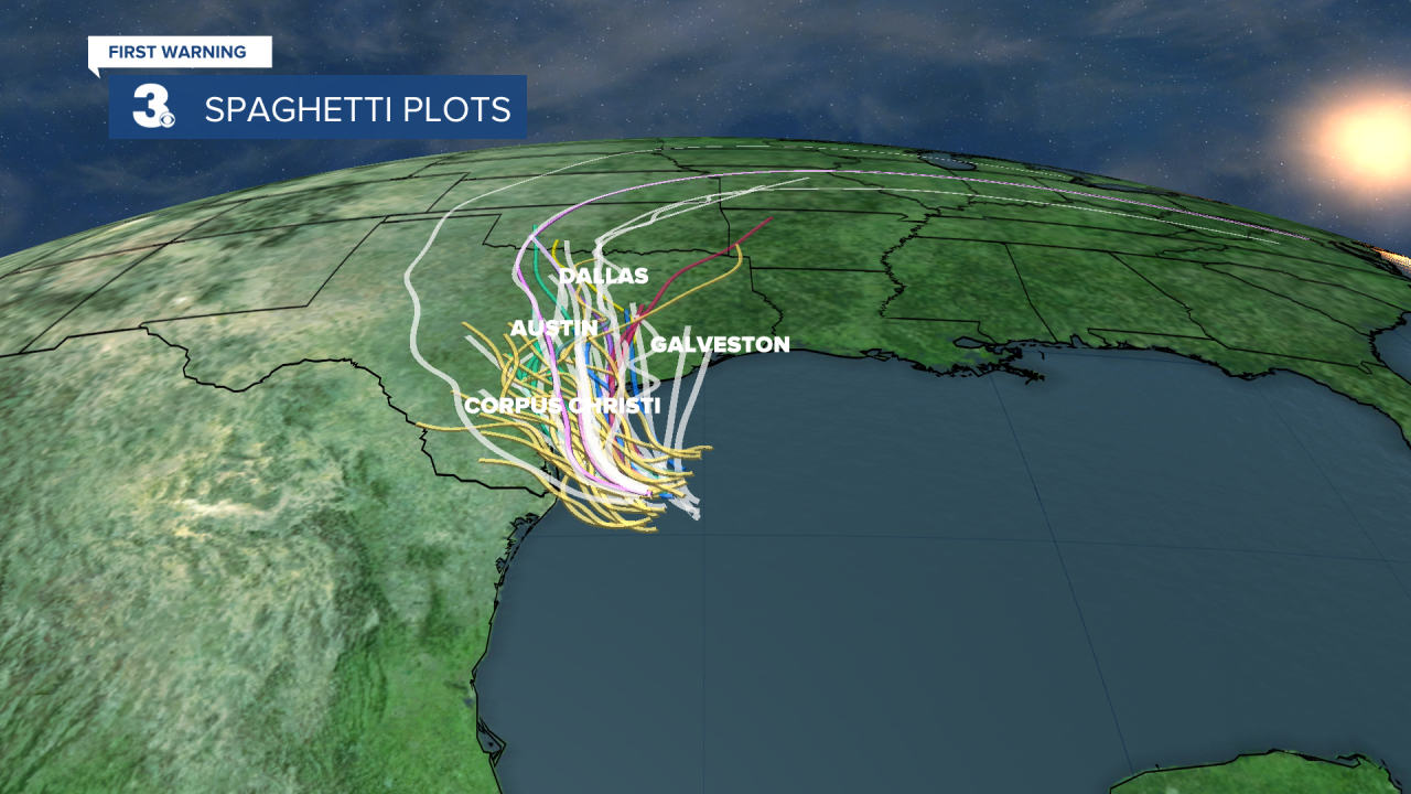
The third area being watched is in the Gulf of Mexico near the Texas coastline. This one has a 40% chance of formation in both the next 48 hours and next 5 days. It will bring heavy rain across Texas the next few days, regardless of formation.
Connect with Meteorologist Kristy Steward:
