


Meteorologist Kristy Steward's First Warning Forecast
Happy Saturday night! Overall, it’s been a pretty nice day, just a handful of showers and storms popping up this afternoon and evening. Expect more scattered storm activity Sunday. The heat and humidity also starts to creep back in.
Isolated to widely scattered storms continue this evening, ending tonight. Clouds increase overnight and temperatures stay warm in the upper 60s to low 70s.

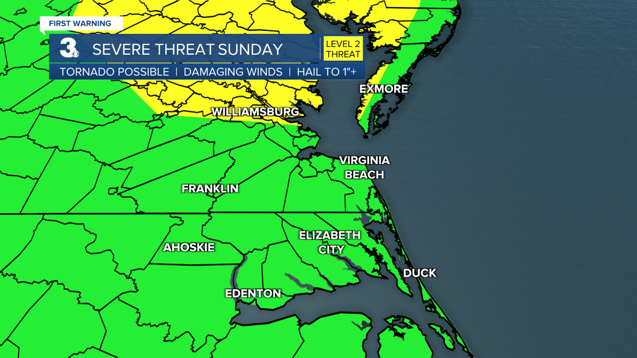
We’ll be warmer and more humid Sunday. Highs in the mid 80s, feeling like we’re closer to 90°. Throughout all of Sunday, we’ll see scattered storms. Not a washout event, but rounds of storms throughout the day. There’s a level 2 of 5 risk for severe storms across the Middle Peninsula and western half of the Eastern Shore. Everyone else is under a level 1 of 5 risk for severe storms. These stronger storms are likely Sunday afternoon and evening. The main threat is damaging winds. We could see some hail too.
Monday will feel just like the depths of summer. High temperatures in the mid 90s, feeling like 100-105°. Isolated storms are possible later Monday afternoon/evening.
We stay hot and humid with isolated storms Tuesday. Highs in the low 90s and plenty of sunshine. Tuesday also looks to be breezier.
Temperatures get a little cooler Wednesday with highs dropping into the mid 80s. Temperatures creep back up to the upper 80s Thursday and near 90° Friday.

Scattered storms return around a cold front Friday. This cold front will cool us down into the low to mid 80s Saturday. We should also be able to lose the humidity and enjoy plenty of sunshine Saturday.
Connect with Meteorologist Kristy Steward:
