


Meteorologist Kristy Steward's First Warning Forecast
Happy Thursday evening! A coastal low pressure system will impact us Friday into Saturday and leave behind strong winds the rest of the weekend into next week.

A mostly clear sky remains tonight. Temperatures drop to around 40°.
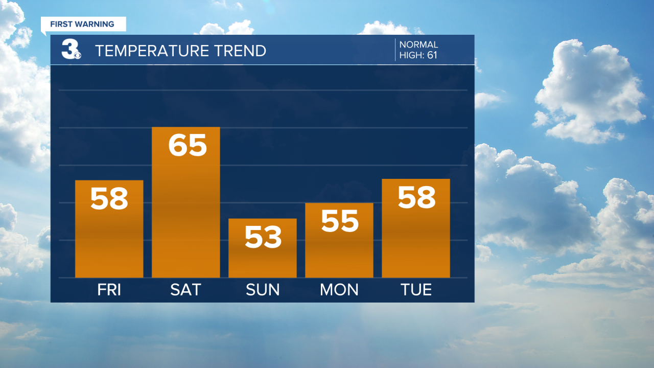
Clouds increase throughout the day Friday and winds begin to pick up. Easterly winds of 10-20 MPH. High temperatures will be a few degrees warmer in the upper 50s. Friday evening, scattered rain showers begin moving in after 5 PM. Rain showers become more widespread and heavier throughout the night and Saturday morning.

Saturday will be a very wet and windy day, but also warmer. Highs in the mid 60s. Southerly winds of 15-25 MPH with gusts up to 40 MPH along the coast. It will be a soggy morning with widespread rain and embedded thunderstorms. We’ll dry out in the afternoon.
The Outer Banks is under a level 1 of 5 risk for severe storms Saturday. Damaging wind gusts and heavy downpours are the primary concerns.

Sunday will be drier with clearing clouds, but still very windy. Northerly winds of 20-30 MPH gusting to 40 MPH. With these strong northerly winds, expect tidal and coastal flooding. Temperatures will be cooler with highs back down to the low to mid 50s.

The workweek starts off dry with plenty of sunshine. Winds remain gusty. Northeasterly winds of 10-20 MPH gusting to 30 MPH Monday and Tuesday. Highs in the mid to upper 50s.
Wednesday warms into the seasonable low 60s, but a cold front on the way brings more clouds and a rain chance later in the day Wednesday lasting into Thursday. Winds pick up around and behind the cold front.
Connect with Meteorologist Kristy Steward:
FACEBOOK
TWITTER
INSTAGRAM
