


Meteorologist Kristy Steward's First Warning Forecast
Happy Saturday evening! An area of low pressure developed on top of the cold front that’s moving through, so we’re seeing more rain than originally anticipated. We’re still on track to have a dry and chilly Sunday before a warm up and more rain next week.
Scattered showers end by 1 AM tonight. Temperatures fall to the lower 30s. Clouds stick around through the night and linger into parts of Sunday. The rest of the weekend will be dry, but chilly. Highs in the upper 40s Sunday.

That is our only chilly day as temperatures soar into the mid 60s Monday and low 70s Tuesday and Wednesday. Clouds gradually increase the first part of the week, but we look to stay mostly dry.
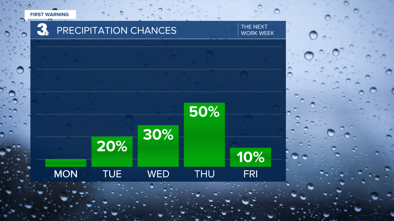
Winds will pick up ahead of our next approaching system too. 10-25 MPH winds Tuesday through Thursday, potentially into Friday too.
Around a powerful cold front, we’ll have scattered showers and thunderstorms throughout the day Thursday. Temperatures will drop to highs in the mid 50s Thursday and around 50° Friday.

Friday will be filled with lots of sunshine that carries into Saturday. Temperatures will warm up some for the weekend. Highs in the upper 50s Saturday.
Connect with Meteorologist Kristy Steward:
FACEBOOK
TWITTER
INSTAGRAM
