


Meteorologist April Loveland's First Warning Forecast
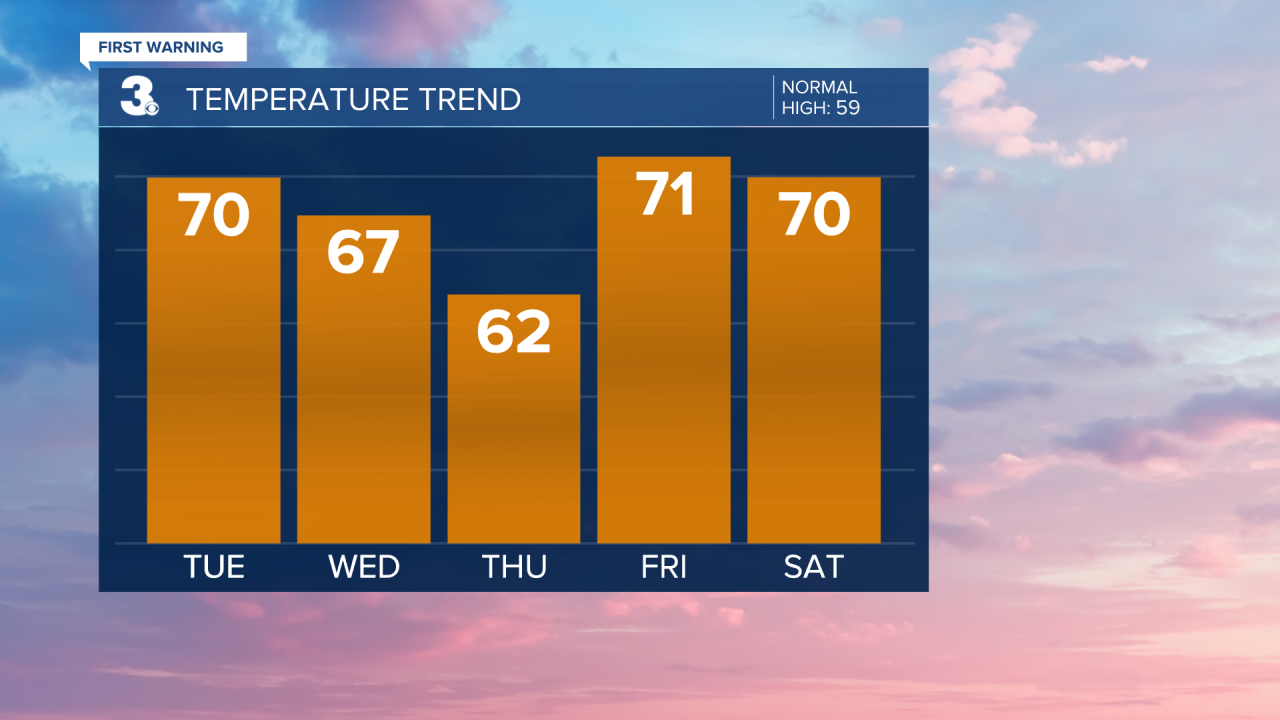
Spring-like temperatures and spring showers on tap this week. Tracking highs in the 60s and even a few 70s!
Skies will be clear overnight with lows in the upper 30s and 40s.

Even warmer on Tuesday with highs in the mid and upper 60s under partly cloudy skies.
Mostly cloudy heading into Wednesday. Highs will be in the low 60s. Scattered showers will be possible by the late afternoon and evening hours.
Shower chances will carry into St. Patrick's Day. Temperatures will be in the low 60s.
Another warm up just in time to end the work week. Highs on Friday will soar to the low 70s. Skies will be partly cloudy.
Scattered showers will move in for Saturday with highs in the upper 60s.
Meteorologist April Loveland
For weather updates on Facebook: HERE
Follow me on Twitter: HERE
Follow me on Instagram HERE
Check out the Interactive Radar on WTKR.com: Interactive Radar
