


Meteorologist Kristy Steward's First Warning Forecast
Happy Friday night! We had another day with heat and storms. This weekend will be drier, but the heat sticks around for a while longer. Eventually, an end to this heat is in sight! A promising cold front heads our way next week.
Scattered storms continue tonight. These storms are nearly stationary, so they just have to rain themselves out. Watch for ponding and localized flooding on roadways tonight.
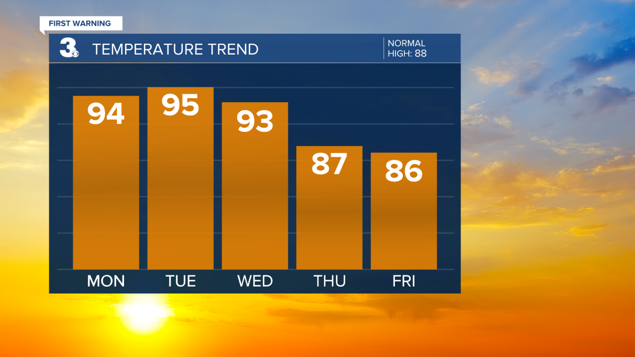
We should dry out by the time most are waking up Saturday morning. We’ll wake up to temperatures in the mid 70s, climbing into the low 90s by the afternoon. Some spotty storms are possible throughout Saturday, but most areas should stay dry.
Similar weather Sunday with highs a couple degrees warmer around 93°. Temperatures continue to gradually climb an extra degree each day into the workweek. Highs Monday and Tuesday will be in the mid 90s, feeling like 105-115°. Tuesday is shaping up to be the hottest day of the week. Not much in terms of relief from afternoon storms either. Mostly dry both days.
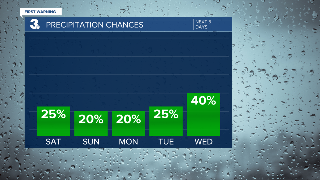
Wednesday will still be hot, but scattered storms return later in the day ahead of an approaching slow-moving cold front. This front will bring us scattered storms Thursday and isolated storms Friday. More importantly, it will bring us a decent cool down! High temperatures Thursday and Friday will be in the middle 80s.
Connect with Meteorologist Kristy Steward:
FACEBOOK
TWITTER
INSTAGRAM
