


Meteorologist Kristy Steward's First Warning Forecast
Good Saturday night! Today was quieter for most of us. Scattered storms stayed mainly across Dare county. The developing low pressure system over us now will move offshore overnight and park itself there most of next week. This will bring us a cooler, windier, wetter pattern with major tidal flooding Sunday throughout most of next week.
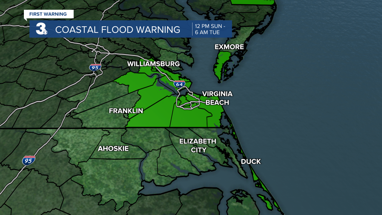
We have a Coastal Flood Warning in effect 12 PM Sunday - 6 AM Tuesday for our Virginia coastal communities. Expect 2-3’ inundation and some road closures. Waves in the Chesapeake Bay and Atlantic Ocean will also be much higher. Sunday 5-7’ waves in the Bay and 9-13’ waves in the Atlantic, higher along the VA coast. Monday and Tuesday 4-7’ waves in the Bay and 10-14’ waves in the Atlantic, higher along the NC coast. A High Surf Advisory is in effect 10 AM Sunday - 6 AM Tuesday. Northerly winds 15-25 MPH with gusts up to 40 MPH will be the cause of this.
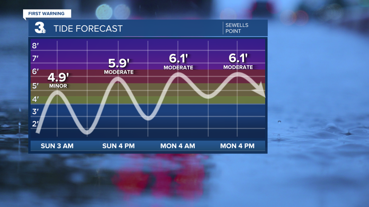
Winds start picking up tonight and we’ll stay windy through Thursday, so I would expect tidal flooding and rough seas to continue through then.
As for the rain, scattered light showers will start to move in tonight. Then they’ll continue throughout all of Mother’s Day. Isolated showers are possible Monday, mainly in the evening hours. Stray to isolated showers continue Tuesday - Thursday. Rain becomes more scattered Friday and storms look to return again Saturday around a warm front.

Temperatures will gradually drop throughout Mother’s Day. We wake up to temperatures in the mid 50s. By the evening, they’ll be in the low 50s, eventually dropping into the upper 40s overnight. Temperatures stay below-average in the upper 50s Monday, low 60s Tuesday, and mid 60s Wednesday. The second half of the week gets warmer. Around 70° Thursday and back to our seasonable highs in the mid to upper 70s Friday into next weekend.
Connect with Meteorologist Kristy Steward:
